


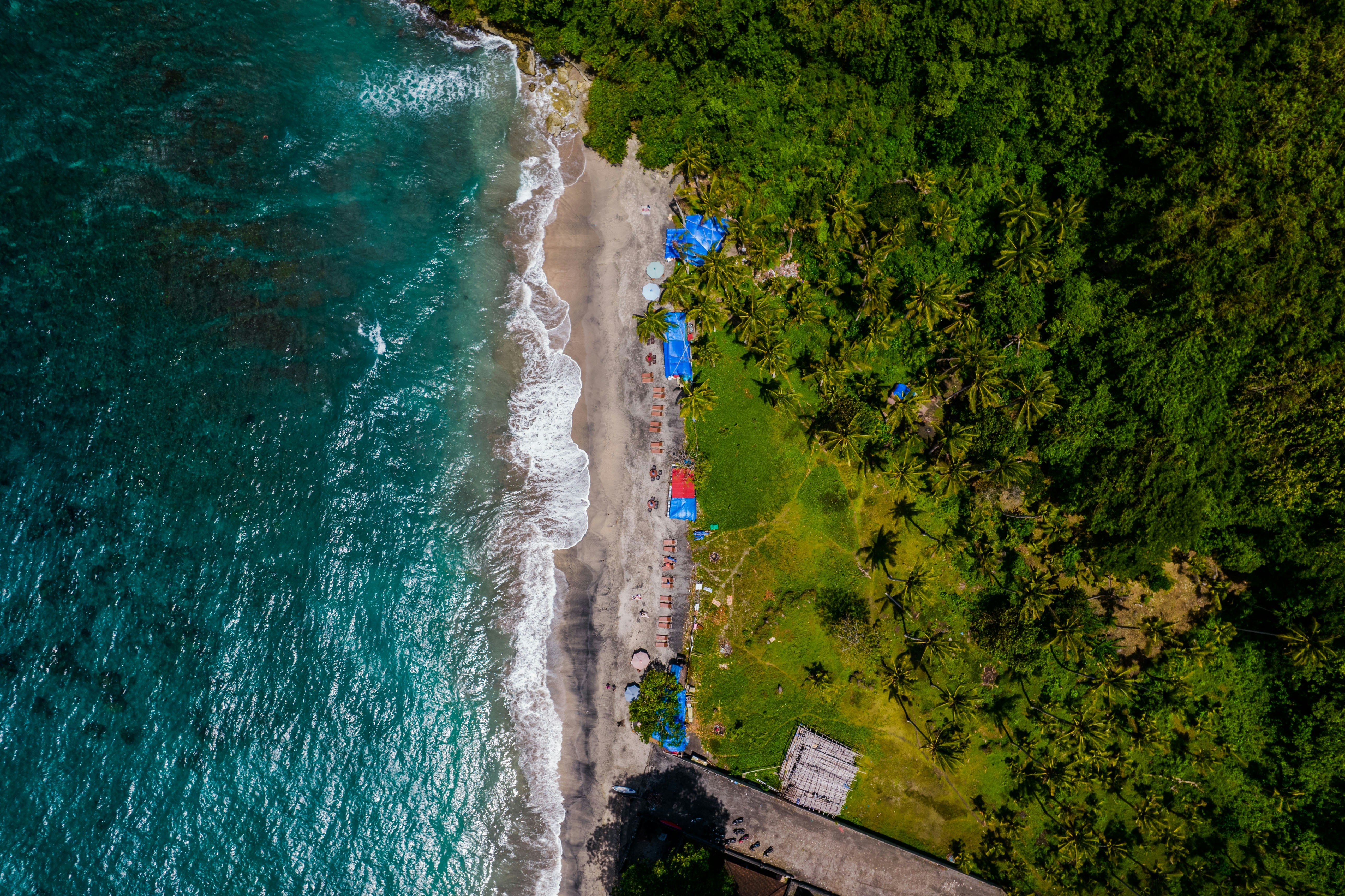
Nyang Nyang Beach & Coastal Wilderness
A dramatic 1.5-kilometer expanse of wild, powdery white sand and rolling coastal surf beneath 100-meter sheer cliffs on Bali’s southernmost tip.
📜 Historical Context & Significance
Historically an isolated fishing landing known only to Pecatu locals, famous for shipwreck remains embedded in the sand and wild oceanic panoramas.
Official Entry Ticket Rates
| Visitor Category | Official Rate (IDR) | Est. (USD) | Inclusions & Notes |
|---|---|---|---|
| Domestic / WNI (Adult) | IDR 0 | $0.00 | Free access |
| Domestic / WNI (Child) | IDR 0 | $0.00 | Free access |
| Foreign Tourist (Adult) | IDR 0 | $0.00 | Free beach access; IDR 5k-10k parking fee |
| Foreign Tourist (Child) | IDR 0 | $0.00 | Free access |
Balinese Cultural Etiquette & Awig-Awig Bylaws
Official village adat guidelines and sacred site protocol for Nyang Nyang Beach & Coastal Wilderness.
Sturdy walking shoes for the cliff descent, swimwear, sun protection.
Awig-Awig Desa Adat Pecatu: No vehicular driving on the open sand; preserve cliff vegetation; zero-waste policy.
Drone Flights Permitted. Exceptional drone arena along the 100m vertical cliffline; maintain vigilance for paragliders launching from the cliff top.
Motorbike/Scooter: IDR 5.000
Passenger Car: IDR 10.000
Transportation & Access Radar
Grab/Gojek drop-off and pickup permitted at the upper cliff parking area.
Low tide is essential for safe reef walking, exploring the iconic shipwreck remnants, and finding calm swimming pools; high tide brings powerful shorebreak surges.
Extremely steep ascent requires high cardiovascular fitness and plentiful drinking water; strong rip currents make swimming beyond the reef shelf dangerous.
Elevation & Accessibility Radar
Navigation & Transit
Visual Highlights & Architecture (7 Photos)
Nyang Nyang Beach & Coastal Wilderness — Aerial perspective revealing the colossal 1.5-kilometer wild white sand crescent beneath soaring 100-meter limestone cliffs.
Photo: Antonio Araujo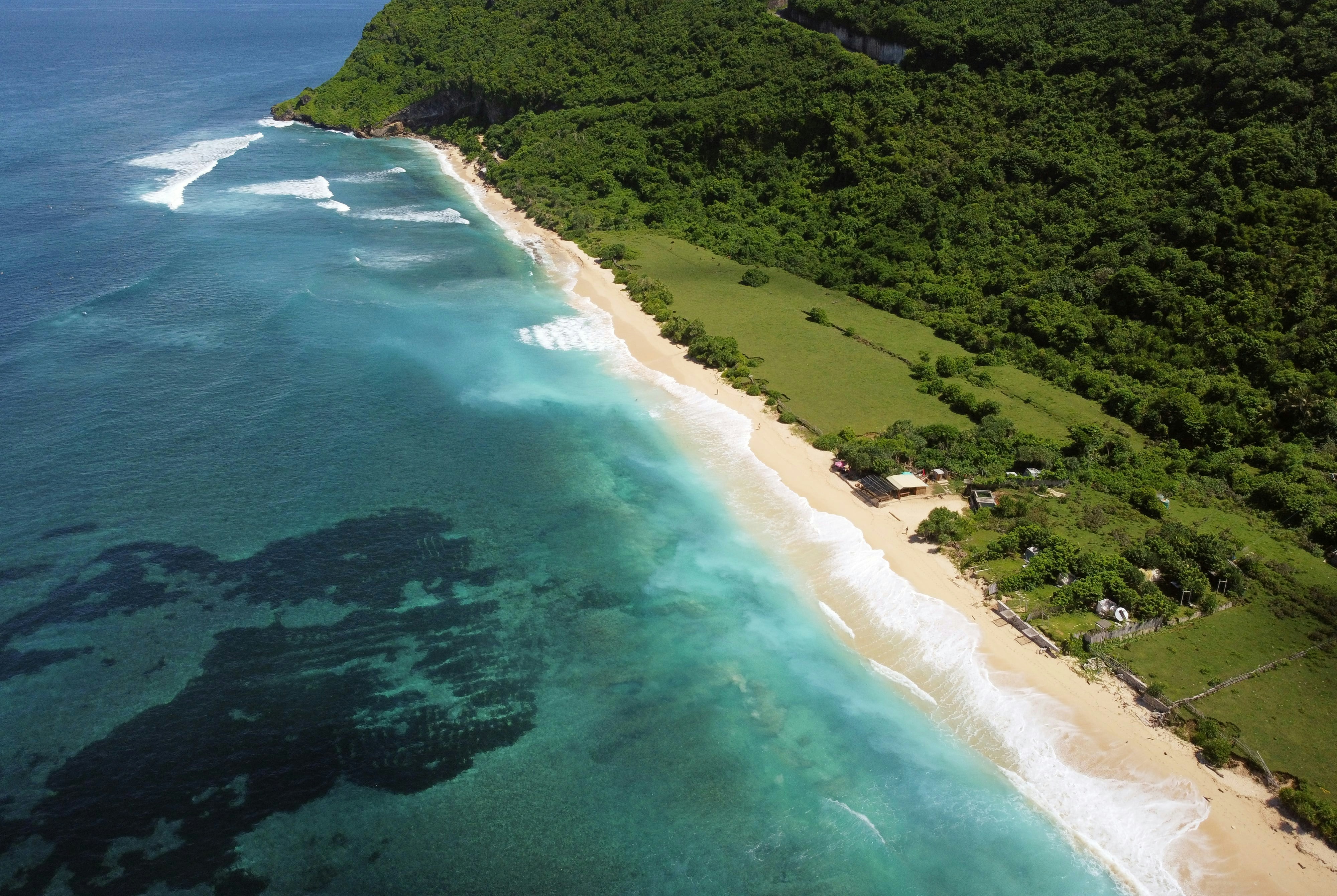
Nyang Nyang Beach & Coastal Wilderness — Towering green-blanketed limestone cliff ramparts dropping vertically to meet the untouched southern coastline.
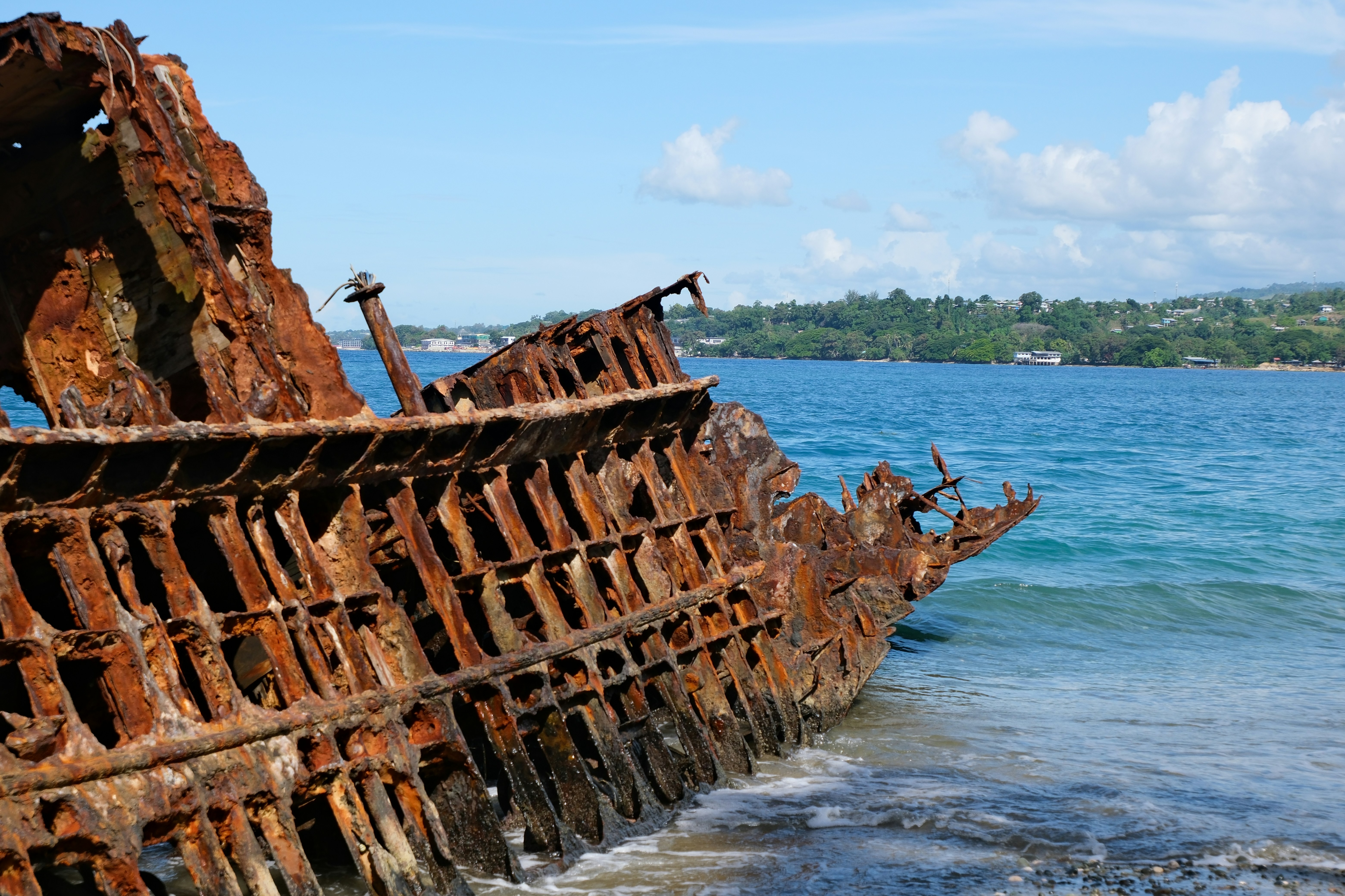
Nyang Nyang Beach & Coastal Wilderness — The iconic weathered vessel shipwreck remnants resting half-buried in the golden-white sand dunes.
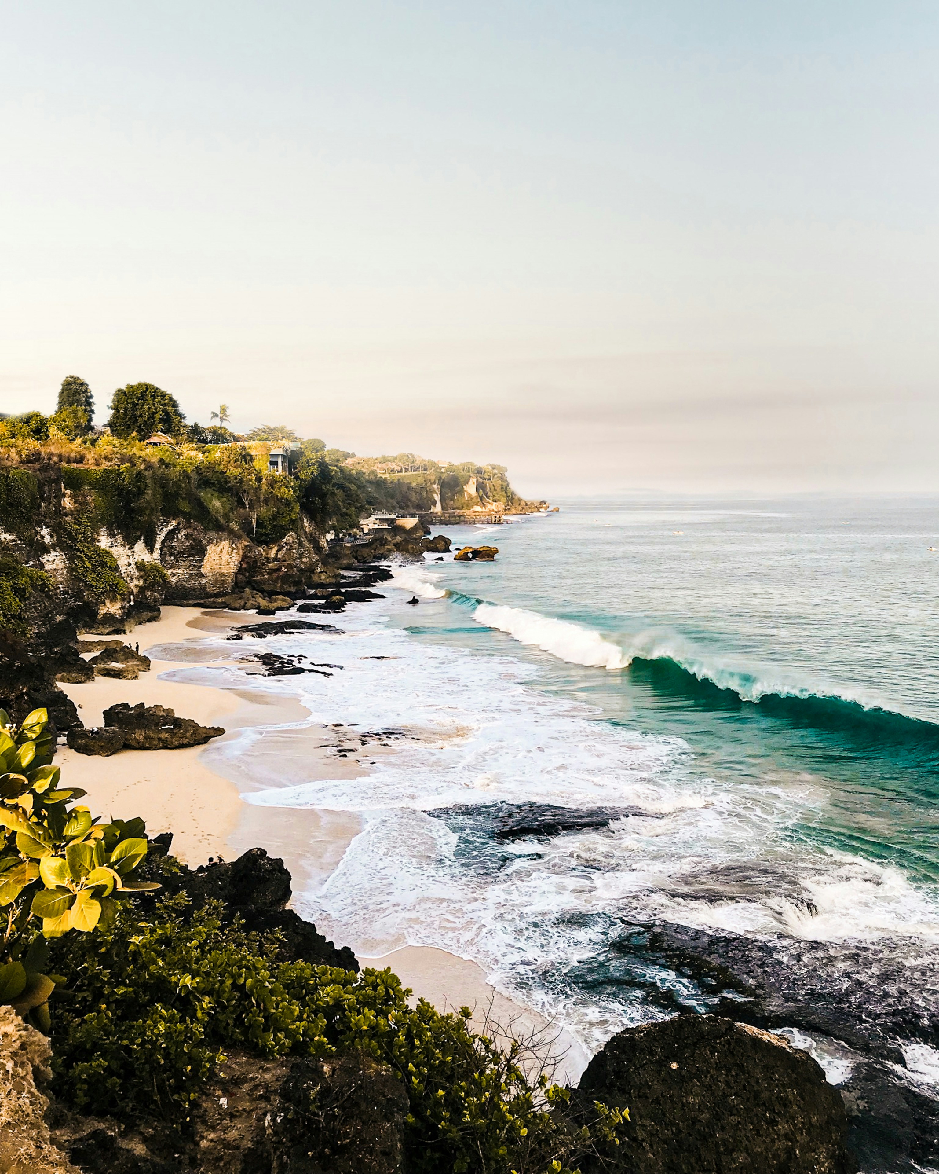
Nyang Nyang Beach & Coastal Wilderness — Vast wild open white sand beach and surging Indian Ocean breakers stretching into the distance.
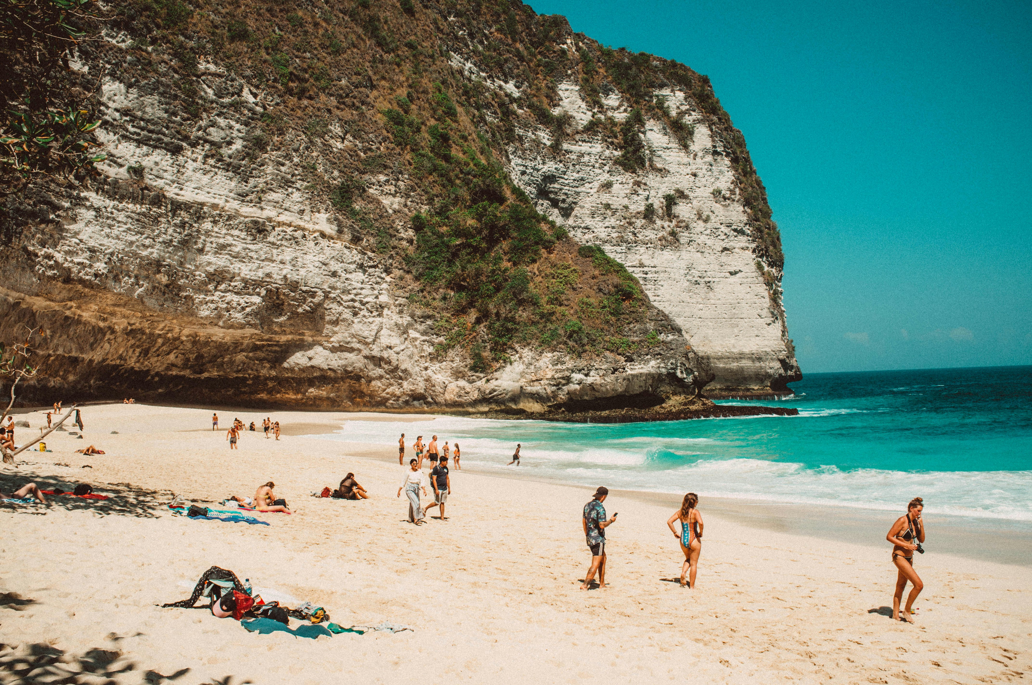
Nyang Nyang Beach & Coastal Wilderness — Solitary wanderers walking along the remote tideline of Bali's most expansive coastal wilderness.
Cultural, Historical & Architectural Guide
Comprehensive Cultural Guide: Nyang Nyang Beach & Coastal Wilderness
1. Comprehensive Overview & Cultural Significance
Nyang Nyang Beach is Bali at its most uncompromising — a vast, untamed expanse of wild white sand stretching 1.5 kilometres beneath sheer 100-metre limestone cliffs at the island's southernmost coastal extremity. It is a beach that requires effort to reach, demands respect to navigate safely, and rewards the adventurous traveler with an experience of oceanic grandeur and solitary beauty that no resort beach on the island can replicate. Among connoisseurs of Bali's natural landscape — the surfers, the coastal hikers, the photographers who seek the unscripted and the genuinely remote — Nyang Nyang occupies a position of special reverence.
The beach's name, repeated twice in the Balinese manner that traditionally signals the extreme or the beyond-ordinary, communicates something of the local community's own relationship with this place. Nyang Nyang is not a beach for casual consumption; it is a destination for those willing to descend the steep access road, endure the midday heat on the exposed sand plain, and submit to the humbling scale of a coastline where human presence feels genuinely peripheral to the drama of sea, stone, and sky. This quality — the sense of visiting somewhere that does not particularly need you — is precisely what makes Nyang Nyang so valuable in an era of over-photographed, over-managed beach experiences.
The beach also carries genuine historical weight in the form of the wartime shipwreck fragments embedded in its sand — iron relics of the Pacific War that serve as an unobtrusive reminder of the violent history that swept through these apparently timeless waters in the 1940s. Combined with the Pecatu community's ongoing ceremonial relationship with this shoreline as a Melasti purification destination, Nyang Nyang offers a layered encounter with both natural and human history that places it well beyond the category of a simple beach visit.
2. Exact Geographic Positioning & Micro-Terrain
Nyang Nyang Beach is positioned at approximately 8.8402 degrees South, 115.0955 degrees East, on the southernmost coastal face of the Bukit Peninsula within Desa Pecatu, Kecamatan Kuta Selatan, Badung Regency. The beach sits at approximately three metres above mean sea level, accessible via a steep unpaved single-track road that descends from the upper cliff plateau — a gradient that has been partly paved in recent years but remains demanding for standard vehicles. Local ojek motorbike taxi drivers station themselves at the upper parking area and offer return trips for approximately IDR 30,000 to IDR 50,000 per person — a service that most visitors gratefully utilise for the return uphill journey after several hours on the open sand.
The approach from the main Pecatu road follows a paved upper road to a cliff-top viewpoint and parking area. From this vantage point, the beach below is visible as a white ribbon between the pale cliff face and the blue-green ocean — a view of such dramatic scale that it frequently prompts visitors to pause long before beginning the descent. The descent road winds down through low coastal scrubland, passing occasional outcrops of exposed limestone and affording progressively closer views of the wave patterns on the outer reef.
On the beach itself, the physical difficulty rating transitions from demanding (for the access road) to moderate (for walking the beach plain). The sand is firm and level at low tide, allowing extensive walking along the full 1.5-kilometre length of the bay. At high tide, the wide sand plain contracts as the sea advances, and the upper beach becomes soft, loose, and tiring underfoot. The cliff base at the northern end of the bay is accessible only at low tide; at high water it is surrounded and should not be approached. The physical exertion of the descent and the heat of the exposed beach make early morning timing (before 11:00) strongly preferable to afternoon visits.
3. Mythological Genesis & Sacred Lore
In the spiritual geography of the Desa Adat Pecatu, Nyang Nyang represents the furthest reach of the kelod axis — the seaward direction that in Balinese cosmology represents the realm of dissolution, purification, and contact with the primal forces of the natural world. As one of the designated coastal landing points for the annual Melasti ceremony — the sacred purification procession conducted in the days preceding Nyepi, the Balinese Day of Silence — Nyang Nyang carries formal religious significance within the community's ceremonial calendar.
During Melasti, which follows the lunar-solar Sasih calendar and typically falls in the weeks before the Balinese New Year, the pemangku (temple priests) of Pecatu lead processions of white-clad devotees to the shoreline, carrying the sacred objects of the village temples — pratima statues, sacred weapons, and ceremonial regalia — to be purified by the ocean's cleansing waters. The choice of Nyang Nyang as a Melasti destination reflects the community's sense that this remote, powerful shore possesses a particularly concentrated form of the purifying ocean energy that the ceremony seeks to invoke.
The wartime shipwreck embedded in the beach sand has acquired a layer of local spiritual meaning over the decades since the Pacific War ended. Some Pecatu elders speak of the wreck site as a place requiring ceremonial acknowledgment — a location where offerings should be placed to pacify any unquiet spirits that might be associated with the violent maritime events that left these iron fragments on the beach. Whether or not this practice is formally maintained, the wreck functions as a powerful focal point for contemplation on the beach, a rusting monument to the contingency of human events against the permanence of geological time.
4. Chronicle of Isolation, Discovery & the Paraglider Pioneers
Nyang Nyang's recorded modern history is a history of progressive discovery rather than dramatic events — a gradual widening of the circle of people who knew this wild beach existed and were willing to make the effort to reach it. For most of the twentieth century, the beach was known only to the Pecatu fishing families and the occasional adventurous surfer willing to scramble down the uncleared cliff face in search of the powerful left-hander that breaks along the southern reef edge on large south swells.
The first significant wave of visitor interest came from the paragliding community, who identified the Nyang Nyang cliff top as one of the most reliable and spectacular thermal launch sites in all of Bali. The consistent south-southeast trade wind, the height and angle of the cliff face, and the unobstructed ocean approach combine to create near-perfect soaring conditions for experienced paragliders during the dry season months. As word spread within international paragliding networks, the cliff top above Nyang Nyang became an established destination on the Bali aerial adventure circuit — bringing with it the first significant infrastructure investment in the form of a cleared launch ramp and a rudimentary parking area.
The beach below gradually became accessible to more general visitors as the access road was progressively improved and the local ojek taxi cooperative established its reliable shuttle service from the cliff top. The advent of social media photography — and the dramatic drone footage opportunities presented by the sheer cliff, the vast sand plain, and the powerful surf — accelerated discovery significantly through the 2010s, though Nyang Nyang's physical demands and remoteness have continued to maintain a natural filter on visitor numbers that has preserved much of the beach's wilderness character.
5. Architectural Anatomy & Geological Relics
The geological architecture of Nyang Nyang is dominated by two features of extraordinary scale: the 100-metre sheer limestone cliff face and the 1.5-kilometre sand plain below it. Together, they constitute a coastal landscape of a drama and grandeur that places Nyang Nyang in the company of the world's great natural coastal spectacles.
The cliff face records Pleistocene reef history in vivid stratigraphy. The differential erosion of limestone layers of varying hardness has produced the characteristic weathering morphology of advanced karst: undercut cliff bases where weaker strata have been removed by wave action, leaving overhanging caps of harder limestone; vertical fluting channels carved by freshwater runoff; and occasional collapse scars where sections of cliff face have failed along pre-existing joint systems, sending blocks of limestone cascading to the beach below.
The shipwreck remains at the beach's southern end constitute the most historically significant physical relic at Nyang Nyang. At low tide, sections of heavily corroded iron plating, structural members, and mechanical components are visible protruding from the sand, encrusted with coralline algae and barnacles and colonised by small reef fish that use the complex metal surface as artificial reef habitat. The wreck fragments are spread over a considerable area of beach, suggesting that the vessel broke apart on the reef and its components were distributed along the shore by longshore drift over the intervening decades.
The outer reef visible as a white-water line from the beach is a living coral reef system of considerable biological diversity, though it has suffered the bleaching and physical damage that have affected reefs throughout the Coral Triangle in recent decades. At extreme low tide, the emergent portions of the reef flat reveal a complex three-dimensional structure of massive coral heads, branching coral colonies, and reef-flat rubble — a reminder that Nyang Nyang's dramatic beach landscape is underlain by a living ecosystem of extraordinary complexity.
6. Essential Etiquette, Awig-Awig & Safety Imperatives
Nyang Nyang operates under the awig-awig of the Desa Adat Pecatu, which establish both cultural etiquette and practical safety requirements:
- No Vehicular Driving on the Sand: The awig-awig explicitly prohibit driving any motorised vehicle onto the beach sand — a protection that preserves the surface integrity of the beach and the nesting habitat of shorebirds.
- Cliff Vegetation Preservation: The vegetation on the cliff face and cliff top is a critical stabilising element preventing erosion of the limestone escarpment. Visitors must not cut, remove, or damage any cliff vegetation.
- Zero-Waste Policy: There are no waste facilities on the beach. All refuse must be carried back to the cliff top.
- Swimming Advisory: The powerful rip currents beyond the inner reef shelf make open-ocean swimming at Nyang Nyang genuinely dangerous. Swimmers should confine themselves to the shallow inner zone between the beach and the reef edge, and should be able to identify the darker, smoother rip current channels before entering the water. Never swim beyond the reef break under any circumstances.
- Drone Use: Nyang Nyang offers an exceptional aerial photography arena along the sheer cliff line. Operators must maintain awareness of paraglider traffic launching from the cliff top above, as paraglider lines and drone propellers are a lethal combination.
7. Practical Logistics & Tidal Planning
- Getting There: Access is via the paved upper Pecatu road leading to the cliff-top viewpoint and parking area. Grab and Gojek provide drop-off at the upper viewpoint; the return signal is strong at the top parking area. From the parking area, visitors either walk or engage the local ojek cooperative (IDR 30,000-50,000 return) for the steep descent road.
- Tidal Timing: The massive sandy plain is walkable at all tidal states, but the widest exposure and most explorable conditions occur at low to mid-tide. The reef flat is walkable with appropriate footwear at extreme low tide. High tide brings the sea to the cliff base in sections of the beach; check local tide tables before visiting.
- Best Time of Day: 08:00 to 11:00 captures cooler temperatures for the descent and ascent, and the early morning light bathes the white sand in spectacular warm tones. Midday visits on the open, shadeless beach in the dry season are genuinely demanding in terms of heat exposure.
- What to Bring: Large quantities of drinking water (there are no vendors at beach level), reef-safe sunscreen, a wide-brimmed hat, sturdy footwear for the road descent and reef exploration, a carry bag for waste removal, and a snorkel for reef-edge investigation at low tide.
- Operating Hours: 06:00 to 18:30 daily.
8. Entry Tariffs & Transparent Inclusions
Nyang Nyang Beach does not charge a formal admission tariff. Access is free of cost, with the following associated fees:
- Foreign Adult: IDR 0 — Free beach access
- Foreign Child: IDR 0 — Free access
- Domestic Adult: IDR 0 — Free access
- Domestic Child: IDR 0 — Free access
- Parking (Car): IDR 10,000 at the upper cliff viewpoint
- Parking (Scooter): IDR 5,000 at the upper cliff viewpoint
- Ojek Shuttle (Optional): IDR 30,000 to IDR 50,000 return per person from the cliff top to the beach
The ojek cooperative provides a genuine service to visitors — the steep descent road is manageable on foot but the return ascent is exhausting, particularly after several hours on the open beach in the heat. Engaging the shuttle service also provides a direct economic contribution to the local Pecatu family cooperative.
9. Sustainable Tourism & Environmental Stewardship
Nyang Nyang Beach's wilderness character is its most valuable asset and its most fragile attribute. The open, shadeless, facility-free quality of the beach — the very characteristics that make it feel genuinely remote — also make it vulnerable to the cumulative damage of even modest visitor impact. A single day's worth of plastic refuse left on the beach by multiple visitor groups can, within days, be distributed by wind and tide across the entire 1.5-kilometre sand plain, creating a degraded environment that takes months of community effort to restore.
The most important sustainable tourism commitments at Nyang Nyang are the zero-waste imperative and the reef preservation ethic. Both require nothing more of the visitor than the consistent application of intentions most travelers already hold: do not leave rubbish, do not damage the reef, do not take natural objects from the beach. The enforcement of these simple principles, sustained across every visit by every visitor, is what determines whether Nyang Nyang remains the wild, extraordinary place it is today or becomes another degraded relic of a beach that once was beautiful.
Beyond individual visitor behaviour, the long-term conservation of Nyang Nyang depends on the continued effectiveness of the Desa Adat Pecatu's customary governance — a traditional institution that has protected this coastline far longer than any modern regulatory framework. Supporting the community's stewardship capacity, whether through respectful compliance with the awig-awig, positive engagement with local guide and ojek services, or simple expressions of gratitude and regard for the knowledge and care that local families invest in this remarkable shore, is the foundation of any genuinely sustainable relationship with Nyang Nyang Beach.
Wild Shores, Wartime Shadows & the Ancient Coastal Lore of Nyang Nyang
Nyang Nyang Beach occupies the southernmost reaches of Bali's great limestone peninsula, a place where the Indian Ocean arrives without apology, its swells having gathered energy across thousands of unimpeded kilometres of open water before detonating against the ancient coral reef that girds this extraordinary shore. Among the Balinese of Pecatu and the wider Bukit community, the name Nyang Nyang carries connotations of wildness and remoteness — a place beyond the comfortable periphery of village life where the forces of the natural world hold undisputed sovereignty.
The earliest human relationship with this coastline was one of cautious reverence rather than recreational use. The Pecatu fishing families who have lived along the Bukit escarpment for centuries maintained a respectful distance from Nyang Nyang's open-ocean swells, preferring the more sheltered coves to the north for their daily fishing operations. Nyang Nyang was the preserve of the desperate and the brave — those whose boats had been driven south by unexpected storms, or those willing to attempt the treacherous cliff descent in search of the deep-water fish that congregate along the reef's southern edge where cold oceanic upwellings bring nutrients to the surface.
The beach's most dramatic historical artifact is the remains of what local tradition identifies as a Second World War-era shipwreck, whose iron bones lie partially exposed in the wet sand near the southern end of the bay. Fragments of coral-encrusted metal protrude at low tide, drawing the fascinated attention of beachcombers and marine historians alike. While the precise identity and circumstances of the wreck have not been formally documented by Indonesian maritime authorities, local oral tradition speaks of a vessel that came to grief on the reef during the Japanese naval operations of the early 1940s — a period when the waters off Bali's southern coast were contested by competing imperial and colonial forces. The wreck has become an informal monument, a rusting memorial to the turbulent history that swept across these peaceful shores during the Pacific War.
In the spiritual cartography of the Desa Adat Pecatu, Nyang Nyang represents the kelod extreme — the most seaward point of the community's ritual geography, farthest from the sacred volcanic mountains of the island's interior. This liminal positioning gives the beach a particular character in local ceremony: it is one of the designated landing points for the annual Melasti purification processions during the days before Nyepi, when sacred objects from the village temples are carried to the sea to be symbolically cleansed by the ocean's purifying waters. To witness the procession of white-clad devotees descending to Nyang Nyang's wild shore is to witness Balinese Hinduism at its most elemental — the meeting of the human community with the vast indifferent power of the sea, the ritual act of asking the universe for renewal.
The coastal wilderness character of Nyang Nyang has been maintained by a combination of geographic inaccessibility and the protective provisions of the Desa Adat Pecatu's awig-awig, which prohibit vehicular driving on the open sand, mandate a zero-waste policy for all visitors, and require the preservation of the cliff vegetation that stabilises the escarpment above the beach. These protections ensure that Nyang Nyang retains the raw, untouched quality that makes it such a powerful counterpoint to the more developed beaches of Bali's western and southern coasts.
Sheer Limestone Cliffs, Coastal Geology & the Open-Ocean Dynamics of Nyang Nyang Beach
Nyang Nyang Beach presents what is arguably the most dramatic coastal geological display available to the ground-level observer anywhere on Bali's southern peninsula. The sheer limestone cliffs that rise 80 to 100 metres directly above the beach are composed of the same Pleistocene-age raised coral reef limestone that forms the structural backbone of the entire Bukit Peninsula, but at Nyang Nyang, the scale and verticality of the cliff face reaches its most theatrical expression. These walls of pale, fossil-studded stone drop almost without interruption from the scrubland plateau above to the beach level below — a cliff-face so sheer in places that the descent road, newly paved in recent years, must negotiate a gradient that pushes the limits of two-wheel-drive traction.
The cliff face itself records the stratigraphic history of ancient reef growth in exceptional clarity. Horizontal banding of different limestone colours and textures — pale creamy layers alternating with darker, more iron-stained bands — reflects the episodic accumulation of reef-building organisms over tens of thousands of years during the Pleistocene epoch. Within these bands, the trained eye can identify the preserved outlines of massive coral colonies, the branching forms of staghorn and table corals fossilised in growth position, and the burrow structures of bivalves and worms that inhabited the reef's sediment apron. Nyang Nyang's cliff is, in effect, a 100-metre vertical section through a fossilised reef ecosystem, as informative to the geologist as it is dramatic to the aesthetic observer.
The beach plain itself is remarkable for its scale: at 1.5 kilometres in length, Nyang Nyang is one of the longest uninterrupted stretches of white sand on the Bukit Peninsula. The sand is overwhelmingly calcareous in composition, derived from the erosion of the adjacent reef system and the mechanical breakdown of the cliff-face limestone by wave action. At low tide, the beach is extremely wide — in some sections more than 100 metres from the cliff base to the waterline — revealing a vast tidal flat of compacted wet sand traversed by shallow rills of draining seawater. This exposed tidal plain is the beach's primary attraction at low water: an almost surreal expanse of space and silence, interrupted only by the distant roar of waves breaking on the outer reef edge.
The oceanographic character of Nyang Nyang is shaped by its south-facing exposure and its position on Bali's southernmost coastal extremity. Swells arriving from the Southern Ocean and the broad fetch of the Indian Ocean strike the reef with considerable energy, generating a powerful shore-break and persistent rip currents that make open-ocean swimming genuinely hazardous beyond the inner reef shelf. The reef edge is visible from the beach as a line of white water at varying distances offshore depending on tidal state; at extreme low tide, the emergent reef flat can be walked with care and appropriate footwear. The strongest rip currents form in channels between reef sections and are identifiable by the smoother, darker water surface moving seaward between the breaking waves — a signal that demands the respect of even experienced ocean swimmers.
The cliff top above Nyang Nyang has become a significant launch point for paragliders who exploit the powerful updrafts generated by the south-facing limestone escarpment catching the prevailing south-southeast trade wind. The sight of brightly coloured paragliders wheeling above the cliff edge against a backdrop of blue ocean adds a vivid kinetic dimension to the beach landscape below, and constitutes a unique aerial perspective on the geological spectacle that surrounds this wild shore.
Frequently Asked Questions & Local Logistics
Key logistical insights, official tariffs, and customary etiquette for Nyang Nyang Beach & Coastal Wilderness.
Top Curated Stays Near Nyang Nyang Beach & Coastal Wilderness
Curated accommodations within 8km radius, ranked by traveler ratings and shortest transit times.

Nyang-Nyang Retreat

MIZU Boutique Villas Near Nyang Nyang Beach

Kasturi Uluwatu

Prawara Uluwatu
Curated Experiences Near Nyang Nyang Beach & Coastal Wilderness
Curated guided tours and local adventures operated within easy transit of this landmark.

Nyang Nyang Cliffside Tandem Paragliding
Soar along the breathtaking 100-meter limestone sea cliffs of Nyang Nyang with bird’s-eye views of reef breaks and the Indian Ocean.

Karang Boma Sheer Cliff Coastal Walk & Sunset Drift
Traverse limestone headlands with sweeping ocean panoramas and cliffside sunset views.

Bukit Peninsula Secret Beach Trek & Drone Photography Tour
Curated Balinese experience: Bukit Peninsula Secret Beach Trek & Drone Photography Tour. Part of Bali Expert Guide's signature curated journeys.