



Bali High-Wave Warning: What Travelers Need to Know About Fast Boats, Strait Crossings, and Marine Safety This Week
BMKG has issued a maritime advisory forecasting 2.5 to 4.0-meter ocean swells across the southern Bali waters and Lombok Strait through October 10; here is what the alert means for fast-boat crossings, port operations, and island itineraries.
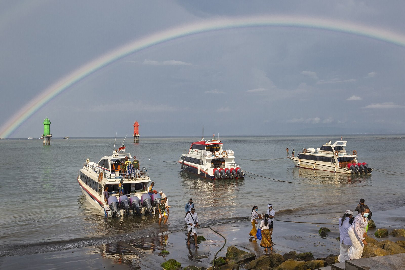
Bali High-Wave Warning: What Travelers Need to Know About Fast Boats, Strait Crossings, and Marine Safety This Week
SANUR, BALI - An active meteorological alert has placed maritime operations across southern Bali and the inter-island transit corridors under heightened scrutiny this week. The Indonesian Meteorology, Climatology, and Geophysical Agency (BMKG), through the Class II Marine Meteorological Station in BBMKG Denpasar, has issued an official early warning forecasting significant wave heights between 2.5 and 4.0 meters across southern Bali waters and the southern Lombok Strait, effective through Saturday, October 10.
The advisory is particularly consequential for Bali’s bustling marine tourism economy. Daily, thousands of international and domestic voyagers board high-speed passenger catamarans and fast boats departing from the modern terminals of Sanur harbor, Padangbai in Karangasem, and Serangan, bound for the popular offshore island enclaves of Nusa Penida, Nusa Lembongan, and the Gili Islands. While elevated wave forecasts routinely generate apprehension among prospective travelers, marine safety authorities emphasize that a meteorological warning is a risk-mitigation advisory - not an automatic, indiscriminate cancellation of maritime commerce.
Understanding the precise oceanographic dynamics behind the BMKG warning allows travelers to make rational, evidence-based itinerary decisions without succumbing to unnecessary travel panic. In an archipelagic destination where island hopping is an essential highlight of the journey, weather data functions not as an inconvenience, but as critical safety infrastructure.
Deconstructing the BMKG Warning: Wave Heights and Geographic Boundaries
The current maritime advisory is driven by persistent southern swell trains originating in the deep southern Indian Ocean, interacting with tidal currents traversing the deep submarine trenches of the Lombok and Bali Straits. BMKG’s marine forecast establishes a clear geographic categorization across regional waters:
| Marine Zone | Projected Wave Height | Category & Operational Impact |
|---|---|---|
| Southern Bali Waters (Indian Ocean Coastline) | 2.5 - 4.0 Meters | High Swell Warning: Direct impact on clifftop coastal surge, reef breaks, and open-ocean navigation |
| Southern Lombok Strait | 2.5 - 4.0 Meters | High Swell Warning: Affects deep-water crossings between southern Bali and southwestern Lombok |
| Badung Strait (Sanur ↔ Nusa Penida/Lembongan) | 1.25 - 2.5 Meters | Moderate Swell: Manageable for medium-to-large multi-engine fast boats under standard precautions |
| Northern Bali Waters (Buleleng Coast) | 0.5 - 1.25 Meters | Slight Swell: Calm, low-risk conditions for coastal tours and traditional dolphin watching in Lovina |
| Northern Lombok Strait (Padangbai ↔ Gili Islands) | 1.25 - 2.5 Meters | Moderate Swell: Navigable for large commercial catamarans; requires localized monitoring around Gili channels |
The data reveals a vital distinction: while the open Indian Ocean south of the Bukit Peninsula and Nusa Penida faces rough 3.6-meter sea states, the semi-sheltered passage of the Badung Strait - where the vast majority of day-trip fast boats operate - remains classified within the moderate (1.25 to 2.5-meter) bracket. Consequently, maritime operations are evaluated on a route-by-route, vessel-by-vessel basis rather than through a blanket shutdown.
How Port Authorities and Fast-Boat Operators Make Sailing Decisions
A persistent source of traveler confusion during swell advisories is the operational protocol governing vessel departures. Prospective tourists frequently assume that if a weather app displays a high-wave icon, all boats are grounded. The reality of harbor management in Bali is substantially more nuanced.
Official sailing clearances are governed strictly by the local Harbor Master’s Office (Kantor Kesyahbandaran dan Otoritas Pelabuhan / KSOP):
- Real-Time Visual and Telemetric Assessment: Harbor master duty officers continuously monitor sea-state cameras, tide gauge data, and barometric trends at Sanur, Padangbai, and Toya Pakeh (Nusa Penida).
- Vessel Size and Engine Capacity: Modern 150- to 200-passenger aluminum and fiberglass catamarans powered by quad 300-horsepower outboard engines possess vastly superior sea-keeping capabilities compared to small, single-hull traditional craft. Larger vessels can safely navigate moderate Badung Strait swells that would be unsafe for open wooden dinghies.
- Harbor Approach Dynamics: The primary hazard during elevated swell periods is rarely the deep ocean itself, but the shallow breakwaters and natural reefs at harbor entrances - particularly at Sanur during low tide or Toya Pakeh where wave surge can compress against coastal limestone.
- Conditional Clearance Protocols: When swell spikes exceed safe thresholds, KSOP enforces tactical sailing suspensions or delays departures until high-tide windows ease harbor-mouth turbulence.
"Our operational mandate is absolute safety without unjustified commercial disruption," explained a licensed marine transport coordinator in Sanur. "When BMKG forecasts swells above 2.5 meters, operators run with reduced passenger capacities, secure all luggage in watertight holds, and adjust cruising headings to quarter the swell rather than taking broadside rolls. If conditions at the arrival harbor turn hazardous, the harbor master issues an immediate holding directive."
The Traveler Experience: What to Expect on Fast-Boat Crossings
For passengers embarking on scheduled crossings to Nusa Penida or Lembongan through October 10, the journey will feel distinctly more energetic than calm dry-season cruising:
- Vertical Vessel Motion: Expect pronounced pitching (front-to-back motion) when transiting out of Sanur harbor through the reef passage into open water. Travelers prone to motion sickness should consume appropriate anti-nausea medication 45 minutes prior to boarding.
- Mandatory Cabin Seating: Operators will enforce strict seating inside the main enclosed cabin; passengers will not be permitted onto open top decks or bow observation platforms while transiting rough water.
- Luggage Waterproofing: While modern fast boats feature covered holds, light sea spray is inevitable during embarking and disembarking at floating pontoons; ensure laptops, passports, and cameras are protected inside waterproof dry bags.
- Schedule Fluidity: Departures may experience 30- to 60-minute holding delays while waiting for favorable tidal windows at harbor mouths.
Marine Tourism Activities: Diving, Snorkeling, and Clifftop Precautions
Beyond passenger ferry crossings, the BMKG swell warning carries direct implications for coastal and marine recreation:
Scuba Diving and Snorkeling
Dive operators in Nusa Penida and Padangbai will re-route daily itineraries away from exposed southern dive sites. Legendary locations such as Manta Point and South Coast Penida, which sit exposed to raw Indian Ocean swells, experience violent surge and hazardous washing-machine currents during 3.5-meter swell events. Reputable PADI and SSI centers will shift dive boats to sheltered northern bays, such as Sental, Ped, and SD Point, where towering limestone cliffs block southern swells, ensuring safe drift-diving conditions.
Clifftop Viewpoints and Coastal Traps
The greatest physical hazard during high-swell episodes is not on boats, but on rocky coastlines. Travelers visiting clifftop landmarks such as Devil’s Tear (Nusa Lembongan), Angel’s Billabong (Nusa Penida), and the rock pools of Kelingking Beach must exercise extreme vigilance:
- Cavitation and Rogue Surges: Deep ocean swells compress violently into subterranean sea caves, erupting through blowholes and washing across clifftop rock shelves without warning.
- The Billabong Surge Trap: Angel’s Billabong is notoriously lethal during swell advisories; waves crash over the outer rock barrier, instantly pulling unsuspecting tourists into turbulent undertows. Never descend into natural infinity pools when swell warnings are active.
- Adhere to Safety Perimeters: Strictly remain behind designated railings and obey local village security (Pecalang) warning whistles.
Essential 6-Point Traveler Protocol for This Week
Travelers with marine crossings scheduled between October 7 and October 11 should follow these pragmatic steps:
- Verify Sailing Status Directly with Your Operator: Contact your fast-boat operator via WhatsApp or telephone 2 to 3 hours prior to scheduled departure rather than relying on generalized social media rumors.
- Never Book Same-Day Flight Connections: If you are staying on Nusa Penida, Lembongan, or the Gili Islands, never schedule a fast-boat crossing on the same day as your international flight out of Bali (DPS). Always return to mainland Bali at least 24 hours prior to long-haul departures to insulate against potential weather holds.
- Accept Operational Reroutes: If dive centers or boat captains modify itineraries to sheltered northern bays, accept the decision gracefully; local maritime professionals possess generational understanding of regional sea states.
- Pack Motion-Sickness Remedies: Carry dimenhydrinate or ginger lozenges, take them well before boarding, and select mid-ship seating where vessel motion is least pronounced.
- Never Coerce Crews to Sail: If a boat captain or harbor master decides that conditions are unsafe to depart, respect the decision without contestation. Pressuring maritime crews to operate against safety protocols creates grave maritime hazards.
- Maintain Itinerary Flexibility: If sea crossings are temporarily paused, pivot your schedule toward mainland cultural explorations in Ubud, Sidemen, or Jatiluwih, resuming marine travel once the swell subsides.
The Right Message: Informed Preparedness Over Unwarranted Panic
The current BMKG high-wave warning does not signify that Bali is experiencing an extreme natural disaster, nor does it mean that travelers must cancel their vacations. It signifies that the Indian Ocean is exhibiting its natural, seasonal wave energy.
In a mature island destination, respecting meteorological advisories is the hallmark of responsible travel. By staying informed, communicating directly with certified boat operators, and respecting the raw power of the ocean, travelers can navigate Bali’s stunning waters safely, comfortably, and with absolute peace of mind.
Planning a trip to Sanur?
Explore current destination intelligence, curated accommodations, cultural landmarks, and island events before you travel.
Curated Stays & Sanctuaries in Sanur
Curated luxury accommodations featuring private pool sanctuaries, authentic architectural heritage, and seamless concierge support.

Andaz Bali
Andaz Bali is a 5-star hotel situated in Sanur, Bali (Ultra-Luxury), holding a verified guest score of 9.5/10 across 753 reviews. Located 12 km (35–50 mins drive)) with short scooter / drive (< 2km to coast).

Bali Beach Hotel
Bali Beach Hotel is a 5-star hotel situated in Sanur, Bali (Ultra-Luxury), holding a verified guest score of 9.4/10 across 1,396 reviews. Located 13.2 km (35–50 mins drive)) with short scooter / drive (< 2km to coast).

Maya Sanur Resort and Spa
Maya Sanur Resort and Spa is a 5-star resort situated in Sanur, Bali (Ultra-Luxury), holding a verified guest score of 9.2/10 across 3,490 reviews. Located 12 km (35–50 mins drive)) with short scooter / drive (< 2km to coast).
Iconic Landmarks & Sacred Sanctuaries Across Bali
Protected cultural heritage, historical architecture, and iconic natural viewpoints with official entrance tariffs and etiquette rules.
 beach landmark
$1.40
beach landmark
$1.40
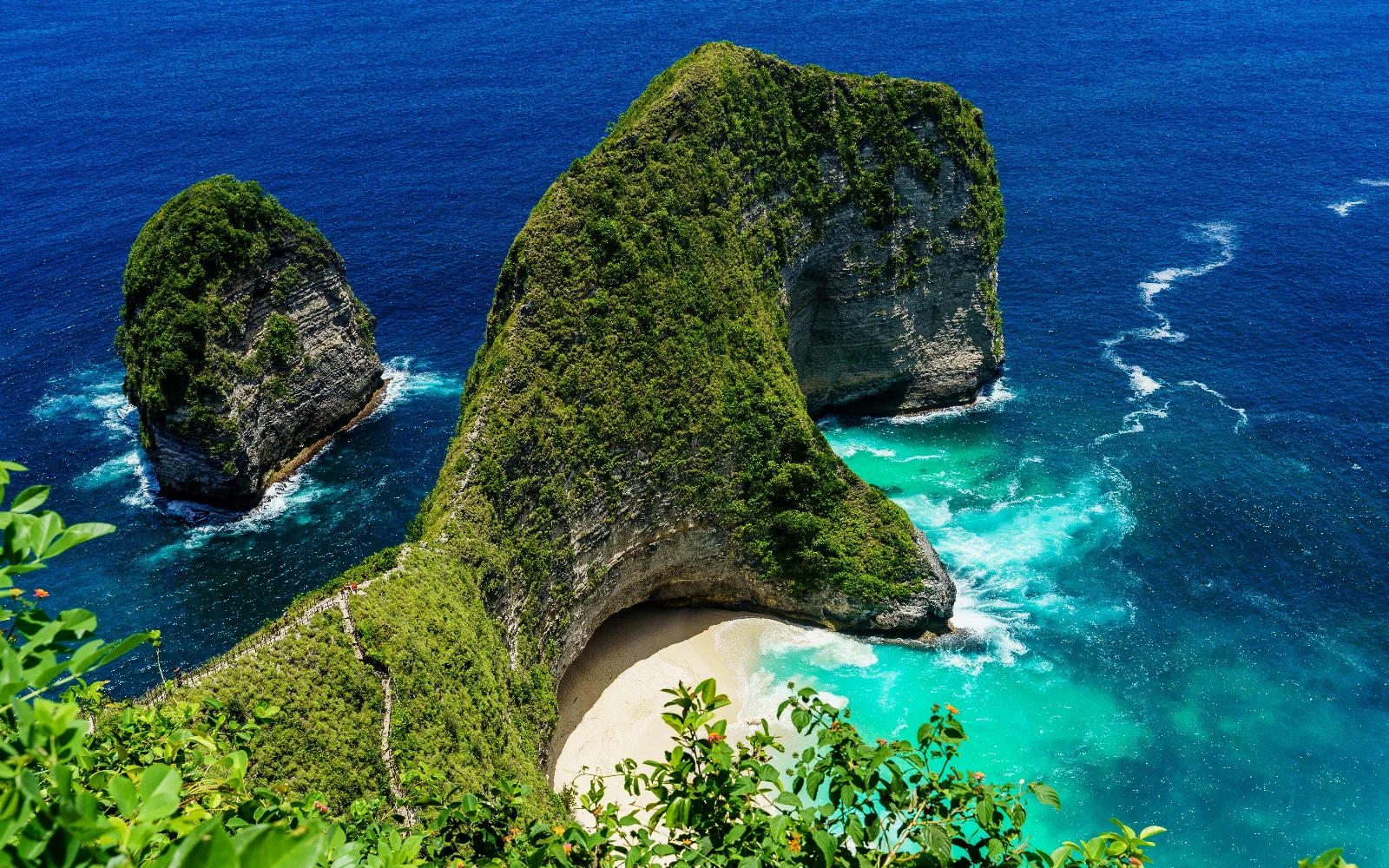
Kelingking Beach (T-Rex Cliff)
World-famous dramatic limestone promontory shaped like a Tyrannosaurus Rex overlooking turquoise seas and powder-white sand.
 cultural village
Free Access
cultural village
Free Access
Mas Wood Carving Village
Mas is the epicentre of Balinese wood carving mastery, where legend holds that the sage Nirartha first taught the art of carving sacred masks and ritual statues to local craftsmen in the 16th century.
 cultural village
$2.79
cultural village
$2.79
Kertha Gosa Pavilion (Royal Court of Justice)
The historic 18th-century supreme royal hall of justice of the Klungkung Kingdom, famed for its masterfully painted Kamasan ceiling frescoes depicting karmic retribution.
Guided Tours & Field Experiences in Sanur
Handcrafted tours, masterclasses, and coastal expeditions led by licensed local guides with verified booking options.
 culture
📍 Sanur
$41.92
culture
📍 Sanur
$41.92
Lempuyang Gate of Heaven & Tirta Gangga Royal Water Palace Day Tour
Comprehensive day journey across Karangasem's royal water architecture, iconic highland temple gates overlooking Mount Agung, and sunbeam-lit canyon waterfalls.
 culture
📍 Sanur
$33.54
culture
📍 Sanur
$33.54
Celuk Village Master Silversmith Jewelry Workshop
Forge, saw, solder, and polish your own bespoke sterling silver jewelry guided by ancestral generational silversmiths in Desa Celuk.
 wellness
📍 Sanur
$11.18
wellness
📍 Sanur
$11.18
Sanur Oceanfront Sunrise Yoga & Pranayama Flow
Breathe with gentle coastal morning breezes as the sun rises over Mount Agung and Nusa Penida on Sanur’s calm sandy shoreline.
Planning a Bali trip?
Explore current destination information, accommodation options, and events before you travel.
Related Travel News & Editorial Dispatches
Stay informed with latest field updates, regulatory notices, and luxury hospitality coverage across Bali and Beyond.
 📍 Sanur
Bali Southern Coast Faces 3.5-Meter Ocean Swells Through October 4 as BBMKG Issues Maritime Advisory
DENPASAR, Bali - October 1, 2026 - The Meteorology, Climatology, and Geophysical Agency Region III Denpasar (BBMKG) has issued an official maritime weather warning for the coastal waters of Bali, forecasting dangerous sea swells ranging between 2.5 and 3.5 meters through Sunday, October 4, 2026. The advisory directly affects southern maritime corridors, fast-boat passenger crossings, commercial dive excursions, and beachfront recreational zones across the island.
 📍 Sanur
Bali - Java Ferry Disruptions Highlight the Island’s Dependence on Food and Logistics Links
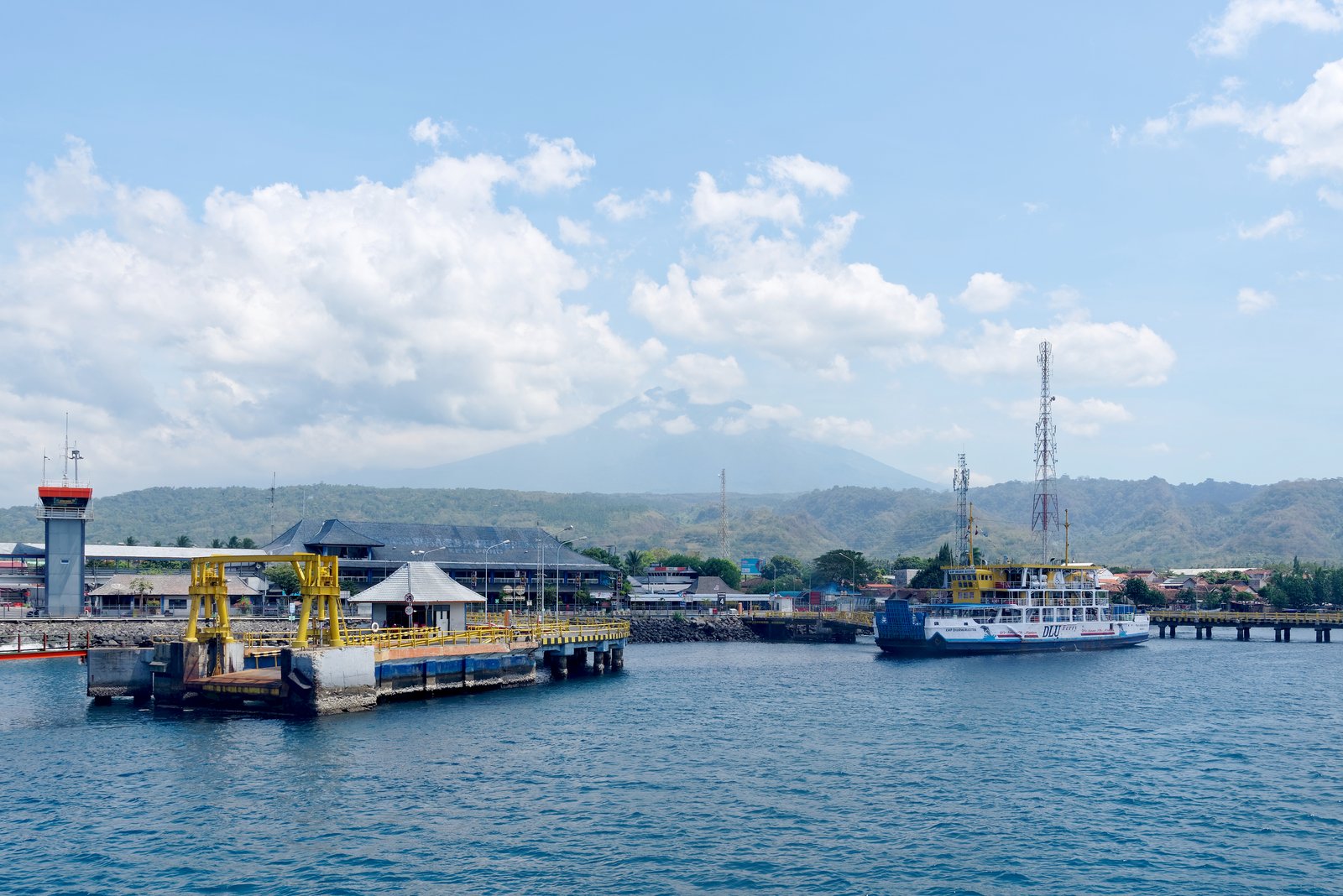
DENPASAR, Bali - September 29, 2026 - The acute, multi-day vehicular gridlock recently experienced along the Ketapang - Gilimanuk ferry corridor in the Bali Strait has reignited urgent policy discussions among provincial economists, business leaders, and government authorities regarding Bali’s systemic vulnerability to single-point maritime supply disruptions.
 📍 Sanur
Bali Workers Push for Higher 2027 Minimum Wage as Wage Talks Begin
DENPASAR, Bali - September 29, 2026 - Labor organizations representing tourism, hospitality and industrial workers across Bali have formally initiated proposals for the province's 2027 Provincial Minimum Wage (Upah Minimum Provinsi / UMP), recommending a benchmark rate of approximately Rp4.5 million per month.
 📍 Sanur
Bali's Southern Coast Under Tidal-Flood Watch Through September 30
DENPASAR, Bali - September 27, 2026 - Bali’s southern coastline remains under a potential coastal flooding and high-tide warning through September 30, with meteorological authorities urging communities and visitors near the coast to remain alert as sea levels rise around the September 26 full moon.
 📍 Sanur
Bali Begins 112 Emergency Hotline Pilot, Bringing Multiple Services Under One Number
DENPASAR, Bali - September 25, 2026 - Bali has been selected as Indonesia’s pilot province for a single emergency telephone number, marking a major step toward integrating the island’s fragmented emergency-response services under 112.
 📍 Sanur
Sanur Prepares for Its Next Tourism Phase as Hospitality Skills Become a Priority
Sanur is entering a new phase of tourism development as the destination continues to position itself around a quieter visitor experience while preparing for the growth of international cruise tourism.