



Mount Rinjani Fire Spreads as 977 Hectares of National Park Are Affected, Closing More Hiking Routes
Lombok, West Nusa Tenggara - September 27, 2026

Lombok, West Nusa Tenggara - September 27, 2026
A wildfire in the Mount Rinjani National Park has expanded significantly over the past several days, prompting authorities to close additional hiking access as firefighters work to prevent the blaze from spreading toward popular trekking routes.
The latest field estimate, according to regional travel authorities and bureau field correspondents, put the area affected by the fire at 977.74 hectares. The fire, first detected around Bukit Setampol on September 22, has spread toward Puncak Sangkareang and areas surrounding the Torean and Senaru sectors of the national park. The estimate remains provisional and is expected to be revised as field teams conduct further mapping and verification.
The latest figure represents a substantial increase from earlier estimates. On September 24, Balai Taman Nasional Gunung Rinjani, or the Rinjani National Park Authority, had estimated the affected area at 589.23 hectares. By September 25, that estimate had increased to 723.7 hectares as the fire continued moving across dry mountain vegetation. Authorities have emphasized that these figures are provisional because the full extent of the affected area can only be established through continued field assessment and aerial mapping.
Senaru Route Closed as Fire Moves Toward the Hiking Area
The expanding fire has already produced a direct impact on visitors.
The Senaru hiking route was closed from September 26, 2026, until further notice, after fire activity moved toward the Pelawangan Senaru area. The decision was announced by the Rinjani National Park Authority as a precautionary measure for hikers and staff working in the affected area.
Visitors who had already purchased e-tickets through Senaru were instructed to reschedule or, where appropriate, change their entry point to Sembalun. Hikers currently on the mountain who had planned to descend through Senaru or Torean were also instructed to follow directions from park officials and use alternative routes where authorized.
The Torean route had already been closed on September 23 following the initial fire at Bukit Setampol. The closure was introduced while authorities assessed the fire and worked to prevent it from spreading toward the hiking corridor.
The reopening of Senaru and Torean will depend on the results of fire suppression efforts and safety assessments by the national park authority.
Firefighting Operations Continue Across Several Sectors
By the evening of September 26, approximately 80 personnel from combined teams had been deployed to different sectors of the national park.
According to the Rinjani National Park Authority, teams were operating around Bukit Setampol, the Torean hiking route, Senaru, Pos 3 Senaru, Pelawangan Senaru and areas leading toward Puncak Sangkareang.
Firefighters were using manual suppression equipment, drones, communications equipment, vehicles and field logistics to monitor and contain the spread. Authorities said the fire at Bukit Setampol had been brought under control in some locations, but teams remained on site to conduct mop-up operations and ensure that remaining embers or hidden hotspots did not reignite.
The situation remains difficult because of the terrain.
The affected areas include steep and remote mountain landscapes where transporting personnel and equipment can take considerable time. Strong winds are also helping flames move through dry vegetation, while mountain grasses, savanna vegetation, shrubs and other organic material have become highly combustible under current conditions.
Weather Is Adding Another Layer of Risk
The wildfire is unfolding during a period of challenging marine and weather conditions across parts of West Nusa Tenggara.
The Meteorology, Climatology and Geophysical Agency (BMKG) has issued a high-wave warning covering several waters around NTB through September 28. The southern waters of Lombok and parts of Sumbawa are included in areas where waves of 2.5 to 4 meters are possible.
BMKG has also noted the influence of strong winds over the region, conditions that can complicate both outdoor activities and firefighting operations in exposed areas.
The combination of dry mountain vegetation, difficult terrain and strong winds is therefore an important part of understanding why the Rinjani fire has been difficult to control.
The Fire Is Not Being Treated as a Volcanic Event
The current emergency is a forest and land fire, not a new volcanic eruption.
Mount Rinjani remains a volcanic mountain, and its geological status is monitored separately by Indonesian authorities. The present closures are linked to the wildfire and the associated safety risks in affected forest and hiking areas.
That distinction is important for travelers because news about a fire on a volcano can easily create confusion about volcanic activity itself.
What This Means for Travelers
Visitors planning a Rinjani trek should not assume that a valid booking automatically means their original route remains available.
The current situation is changing as fire conditions develop, and route access is being determined by the national park authority based on safety.
Travelers with reservations through Senaru or Torean should check the latest instructions from Balai Taman Nasional Gunung Rinjani before traveling to the trailhead. Those already in Lombok should also avoid attempting to enter closed routes independently.
The national park authority has repeatedly asked visitors to follow official instructions and not force access during the closure period.
A Bigger Issue for Lombok Tourism
Rinjani is one of Lombok's most important adventure-tourism assets. The mountain attracts domestic and international trekkers, guides, porters, accommodation providers, transport operators and other businesses across northern and eastern Lombok.
As a result, a prolonged closure can have effects far beyond the trail itself.
When a major trekking route closes, demand can shift toward alternative activities such as beaches, diving, snorkeling, village tourism and other attractions. At the same time, guides, porters and businesses whose income is closely linked to Rinjani trekking can face an immediate reduction in activity.
The current fire therefore represents both an environmental emergency and a tourism-management challenge.
The Earlier Numbers Should Not Be Confused
The rapid changes in reported fire area may appear contradictory when compared across different reports.
The 589.23-hectare figure was the provisional estimate based on monitoring through September 24. The figure increased to 723.7 hectares on September 25, and the latest estimate available from the Rinjani National Park Authority on September 26 was 977.74 hectares.
These are successive estimates of an evolving incident, not competing claims about the same fixed area. The authority has explicitly stated that the numbers can continue to change as aerial imagery, field surveys and boundary verification provide better information.
For now, the most recent available estimate is therefore 977.74 hectares affected, while the fire response remains active.
Protecting Rinjani Beyond This Fire
The immediate priority is containment and visitor safety, but the incident also highlights a longer-term challenge for Lombok.
Rinjani's attraction depends on a fragile high-altitude environment where dry grasslands, forest, mountain ecosystems and trekking routes are all interconnected. Tourism brings economic value to surrounding communities, but the same landscape must remain healthy enough to support visitors in the future.
The latest fire is a reminder that destination management is not only about building tourism capacity. It also involves fire prevention, visitor management, environmental monitoring, emergency response and protection of the ecosystems that make Rinjani a global trekking destination.
For travelers considering Lombok in the coming days, Rinjani should be treated as a changing situation rather than a fixed itinerary. Route status can change with fire conditions, and the latest instructions from the national park authority should take precedence over older booking information or travel content.
Sources: Rinjani National Park Authority; regional observers; National Archipelagic Wire; BMKG.
This dispatch details active operational updates regarding regional transit corridors, airport procedures, park entry permits, or provincial regulations. Travelers are encouraged to verify departure schedules and official requirements prior to transit.
Exploring Lombok & Beyond Bali?
Discover curated regional travel guides, archipelagic flight connections, and signature Bali sanctuaries for your wider Indonesian itinerary.
Curated Stays & Sanctuaries in Bali
Curated luxury accommodations featuring private pool sanctuaries, authentic architectural heritage, and seamless concierge support.

The Oberoi, Lombok
The Oberoi, Lombok is a 5-star resort situated in Lombok & Gili Islands, Lombok (Ultra-Luxury), holding a verified guest score of 9.4/10 across 314 reviews. Located 113.4 km (2–3 hours drive) with absolute beachfront (< 100m).

Holiday Resort Lombok
Holiday Resort Lombok is a 4-star resort situated in Lombok & Gili Islands, Lombok (Upscale Luxury), holding a verified guest score of 8.7/10 across 3,910 reviews. Located 100.5 km (2–3 hours drive) with absolute beachfront (< 100m).

Royal Avila Boutique Resort
Royal Avila Boutique Resort is a 5-star resort situated in Lombok & Gili Islands, Lombok (Ultra-Luxury), holding a verified guest score of 9.6/10 across 890 reviews. Located 100.9 km (2–3 hours drive) with absolute beachfront (< 100m).
Iconic Landmarks & Sacred Sanctuaries in Lombok
Protected cultural heritage, historical architecture, and iconic natural viewpoints with official entrance tariffs and etiquette rules.
 volcano
$8.36
volcano
$8.36
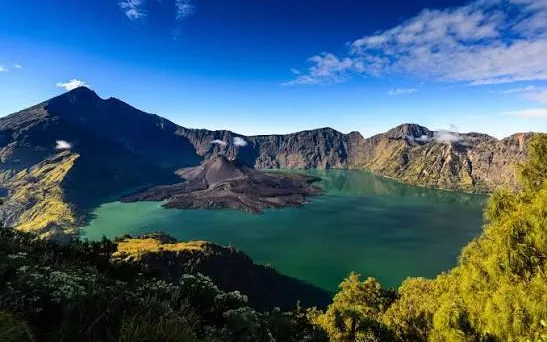
Mount Rinjani National Park & Caldera
Indonesia’s second-highest active volcano (3,726m), featuring the breathtaking turquoise Segara Anak caldera lake, sacred thermal springs, and internationally renowned alpine expedition trails.
 cultural village
$1.39
cultural village
$1.39
Sade Traditional Sasak Village
Living heritage sanctuary preserving 15 generations of indigenous Sasak culture, featuring traditional thatched bale tani architecture, handwoven songket textiles, and customary village governance.
 temple
$1.11
temple
$1.11
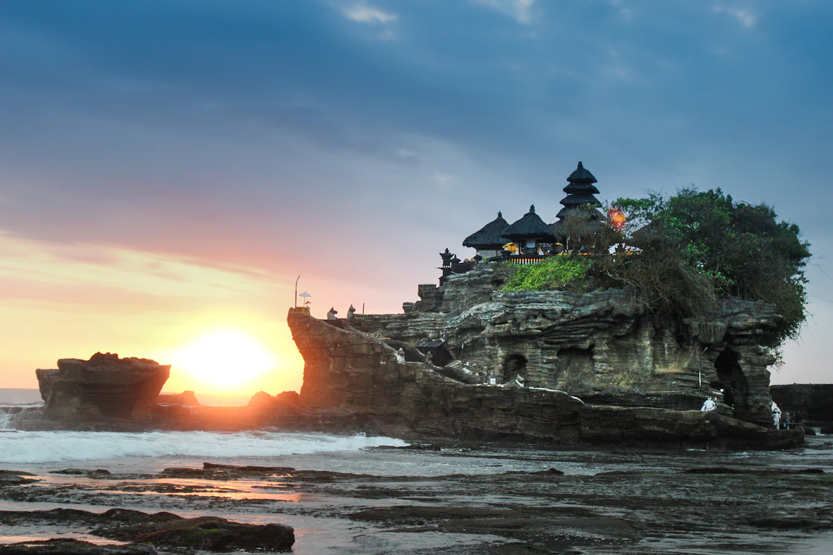
Pura Batu Bolong Lombok
Iconic 16th-century clifftop Hindu sea sanctuary perched upon a dramatic perforated black volcanic rock formation jutting into the Lombok Strait, renowned for majestic sunsets framing Mount Agung.
Guided Tours & Field Experiences Across Bali
Handcrafted tours, masterclasses, and coastal expeditions led by licensed local guides with verified booking options.
 adventure
📍 Lombok
$211.71
adventure
📍 Lombok
$211.71
Mount Rinjani Crater Rim & Summit Trek (3D2N)
Climb to the crater rim of Indonesia’s second-highest volcano for vistas over Lake Segara Anak.
 water marine
📍 Lombok
$47.36
water marine
📍 Lombok
$47.36
South Lombok Secret Gili Snorkeling & Sandbar Safari
Charter an outrigger boat across Gili Nanggu, Sudak, and Kedis with coral gardens and calm waters.
 adventure
📍 Ubud
$36.21
adventure
📍 Ubud
$36.21
Mount Batur Sunrise Summit Trek with Hot Springs
Pre-dawn summit ascent across volcanic basalt ridges to watch the sunrise above Lake Batur and Mount Rinjani, followed by restorative thermal hot springs.
Related Travel News & Editorial Dispatches
Stay informed with latest field updates, regulatory notices, and luxury hospitality coverage across Bali and Beyond.
 📍 Lombok
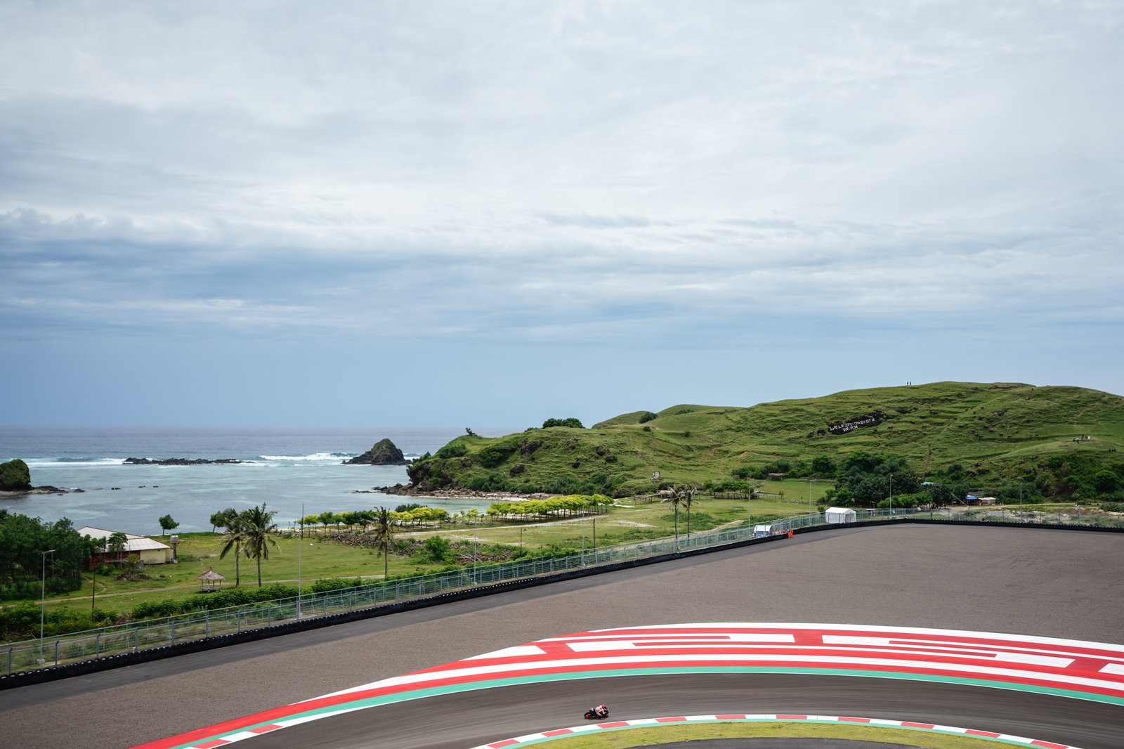
Mandalika Steps Up Circuit and Operational Preparation Ahead of MotoGP 2026
PRAYA, Central Lombok - September 29, 2026 - Operational preparations and technical inspections at the Pertamina Mandalika International Circuit have entered their decisive final phase as circuit management, engineering teams, and race safety authorities finalize preparations for the Pertamina Grand Prix of Indonesia (MotoGP 2026), taking place from October 9 to 11.
 📍 Lombok
Ungu Replaces Juicy Luicy in Mandalika MotoGP Entertainment Line-Up
PRAYA, Central Lombok - September 29, 2026 - The Mandalika Grand Prix Association (MGPA) and event promoter Dyandra Promosindo have officially announced an update to the musical entertainment roster for the upcoming Pertamina Grand Prix of Indonesia (MotoGP Mandalika 2026), confirming that legendary Indonesian pop-rock band Ungu will headline the Saturday night festival stage, replacing pop group Juicy Luicy.
 📍 Lombok
Mandalika International Festival Draws 650 Applicants as Lombok Builds Its Next Tourism Event
Preparations for the fifth Mandalika International Festival (MIF) 2026 are gathering momentum, with 650 people applying for volunteer and management positions ahead of the festival's December program in Central Lombok.
 📍 Lombok
Indonesia Launches Integrated Travel Packages for the 2026 Mandalika MotoGP
Travelers planning to attend the 2026 Pertamina Grand Prix of Indonesia in Lombok can book integrated travel packages combining race access with transportation and accommodation.
 📍 Lombok
Rafa Nadal Tennis Center to Open in Lombok, Creating a New Model for Indonesia's Sport Tourism
Lombok is preparing to add an internationally recognized tennis brand to its tourism proposition with the planned Rafa Nadal Tennis Center at Samara Lombok on the island's southern coast.
 📍 Lombok
Limbungan Traditional House, Hidden Sasak Village at the Foot of Rinjani
The Limbungan traditional house is one of the traditional houses of the Sasak tribe, located in Perigi Village, Suela District, East Lombok, West Nusa Tenggara (NTB). This traditional house is still relatively hidden because it is located in remote Lombok under the foot of Mou...