


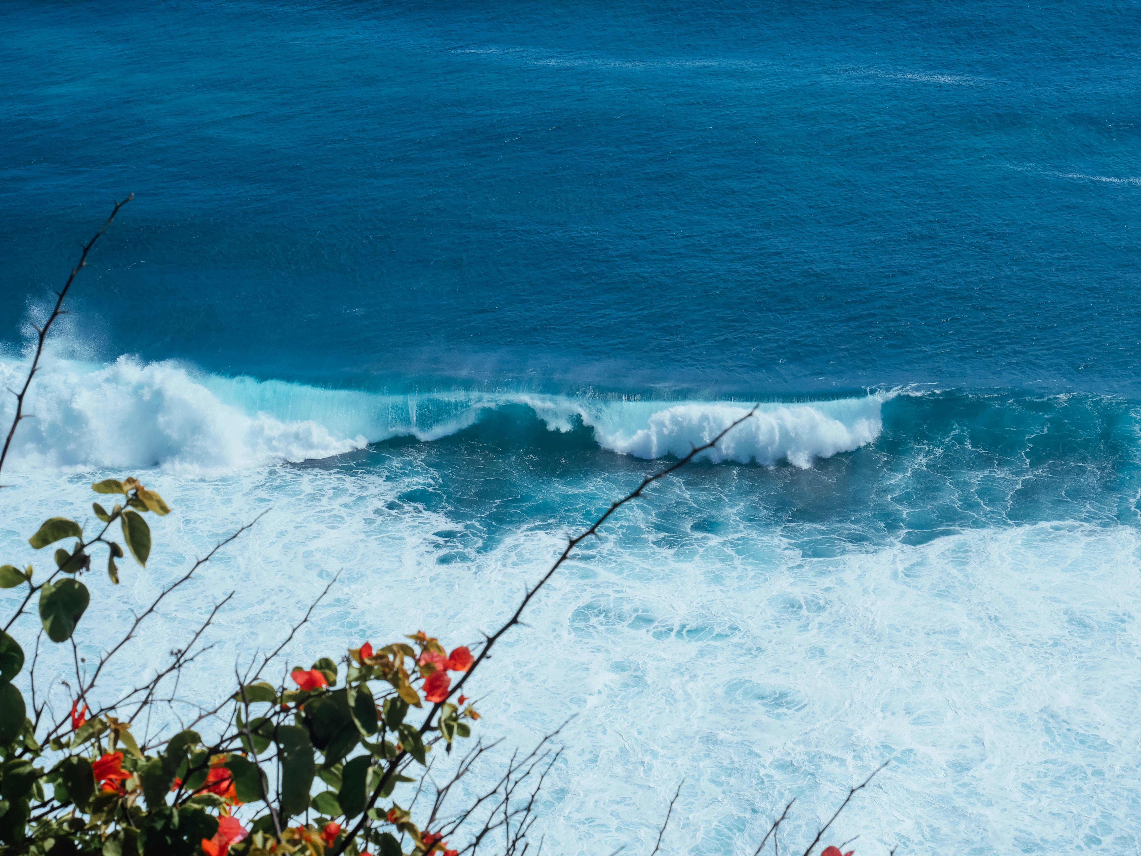
Thomas Beach (Pantai Thomas)
Havre de sérénité secret niché entre Padang Padang et Suluban, cette crique confidentielle de sable blanc velouté et d'eaux aigue-marine offre une retraite intimiste, bercée par de douces vagues et protégée par une falaise verdoyante.
📜 Contexte historique et importance culturelle
Tirant son nom du « Thomas Homestay », l'une des toutes premières pensions familiales balinaises installées sur la crête de Pecatu, ce sanctuaire naturel fut rendu accessible grâce aux escaliers de pierre taillés à flanc de falaise par les aînés du village.
Tarifs officiels des billets d'entrée
| Catégorie de visiteur | Tarif officiel (IDR) | Est. (USD) | Prestations incluses & remarques |
|---|---|---|---|
| Domestic / WNI (Adult) | IDR 0 | $0.00 | Free access |
| Domestic / WNI (Child) | IDR 0 | $0.00 | Free access |
| Foreign Tourist (Adult) | IDR 0 | $0.00 | Free beach access; IDR 5k-10k parking fee |
| Foreign Tourist (Child) | IDR 0 | $0.00 | Free access |
Étiquette culturelle balinaise et règlements Awig-Awig
Directives adat officielles du village et protocole du site sacré pour Thomas Beach (Pantai Thomas).
Tenue de plage, maillots de bain et sandales de marche pour franchir aisément les 160 marches ombragées creusées dans la falaise. Pensez à sécuriser vos effets personnels face aux singes perchés dans la canopée.
Awig-Awig du Desa Adat Pecatu : obligation absolue de remporter l'intégralité de ses déchets au sommet ; interdiction formelle des feux de camp sauvages et des enceintes amplifiées afin de préserver la quiétude de cet écosystème côtier.
Vols de drones autorisés. Vols autorisés au-dessus de la baie turquoise et de la barrière de corail ; maintenez une altitude raisonnable et une distance respectueuse vis-à-vis des personnes profitant du calme sur la plage.
Moto / Scooter : IDR 5.000
Voiture de tourisme : IDR 10.000
Transportation & Access Radar
Grab/Gojek drop-off and pickup permitted along the main road of Jalan Labuansait.
Optimal at low-to-mid tide when wide golden sand strip and calm turquoise swimming lagoons are revealed; high tide submerges most dry sand.
Mind your belongings when swimming; cliff stairs can be slippery when wet after tropical showers.
Radar d'altitude et d'accessibilité
Navigation et transports
Points forts visuels et architecture (7 photos)
Thomas Beach (Pantai Thomas) — Sweeping perspective of the secluded turquoise cove nestled along the Bukit cliffline between Padang Padang and Suluban.
Photo: Lisa A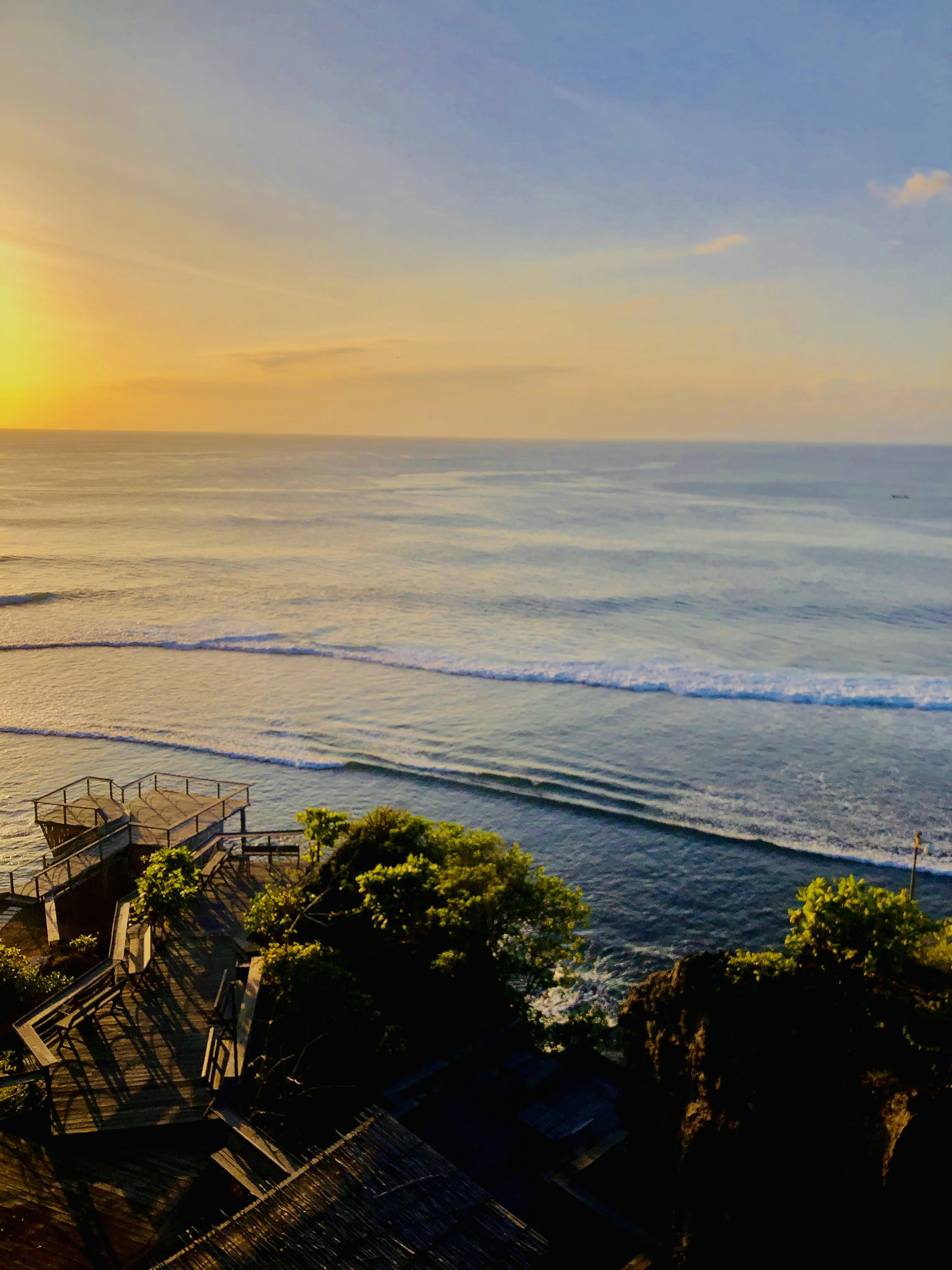
Thomas Beach (Pantai Thomas) — Shaded cliff staircase descending through bougainvillea and coastal trees down to the secluded sand.
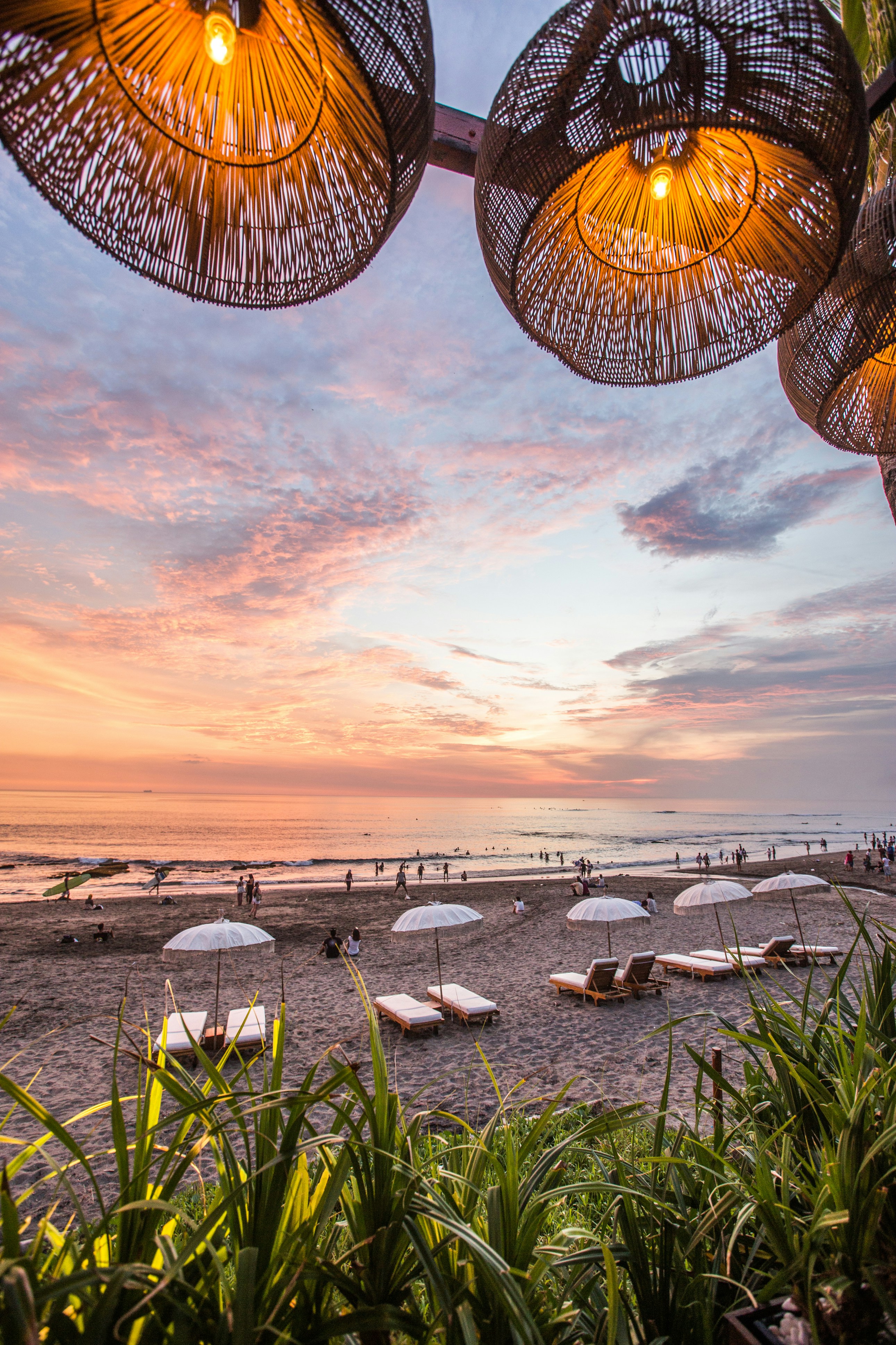
Thomas Beach (Pantai Thomas) — Shaded beach umbrellas and loungers offering relaxed oceanfront seating along the quiet sand.
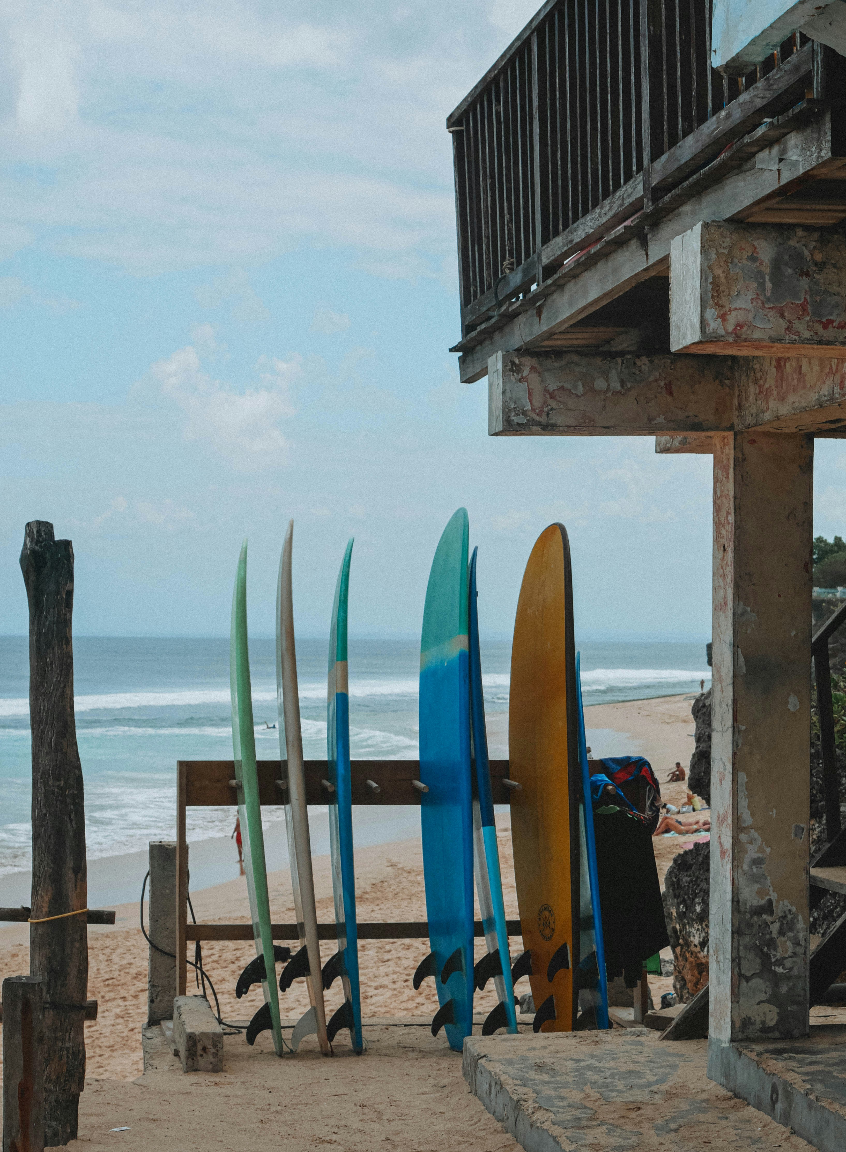
Thomas Beach (Pantai Thomas) — Surfboards and rustic local warung stalls catering to surfers and explorers on the beach.
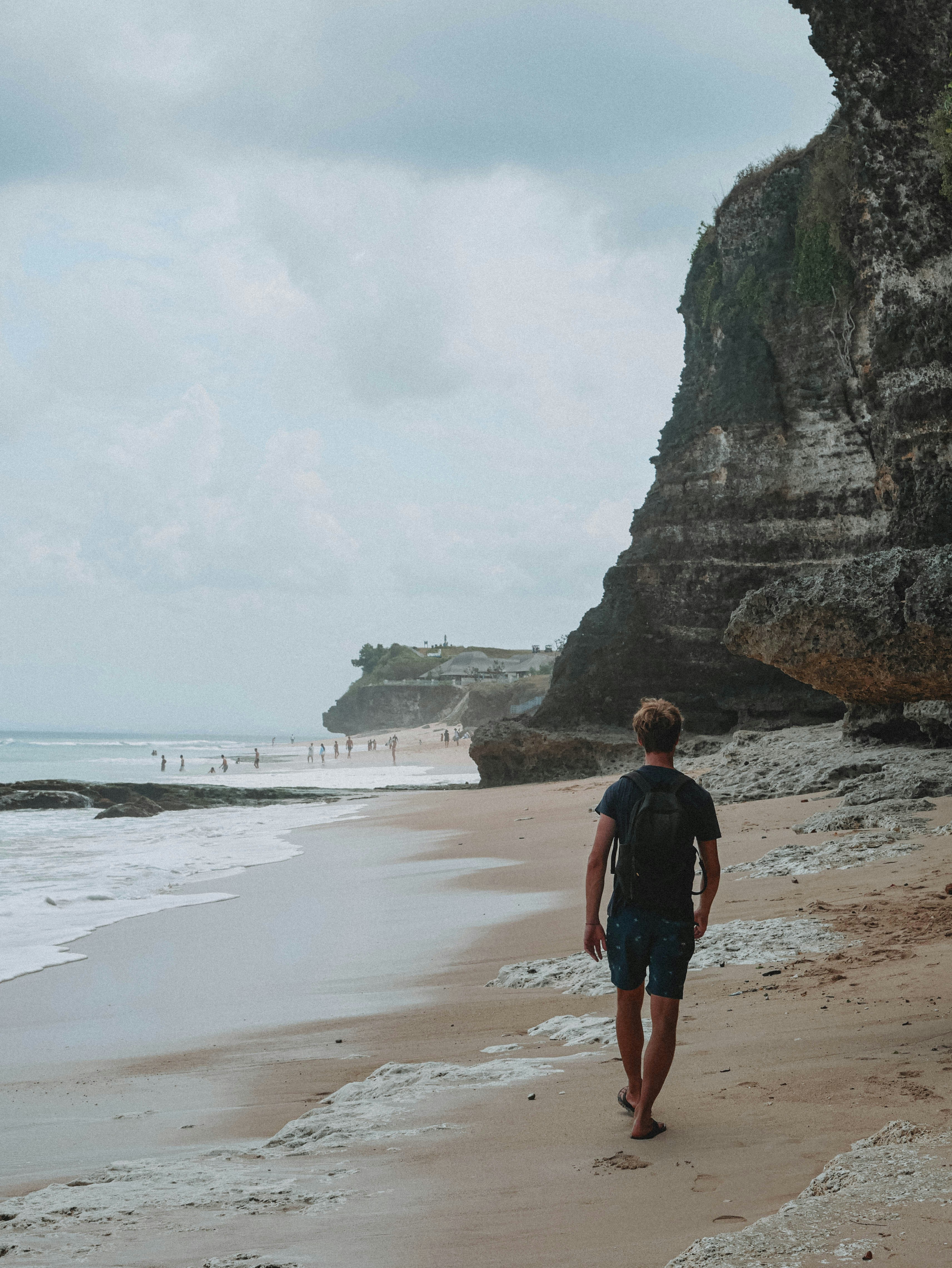
Thomas Beach (Pantai Thomas) — Strolling along the pristine, uncrowded shoreline with translucent turquoise waves breaking softly over the reef.
Guide culturel, historique et architectural
Comprehensive Cultural Guide: Thomas Beach (Pantai Thomas)
1. Comprehensive Overview & Cultural Significance
Thomas Beach — known locally as Pantai Thomas — is among the most quietly extraordinary discoveries available to the discerning traveler exploring Bali's Bukit Peninsula. Positioned between the celebrated surf theatre of Padang Padang to the south and the cathedral rock passages of Suluban to the north, this secluded crescent cove exists in a state of enviable geographic concealment, its existence unmarked by roadside signage and known primarily through word of mouth among those who prize solitude and natural beauty above all else. The beach takes its name from the Thomas family, pioneers of Pecatu's earliest hospitality tradition, who carved the original cliff staircase that now provides the only formal access to the cove — a detail that imbues every descent with a sense of quiet debt to local ingenuity and generosity.
At Thomas Beach, the scale of natural drama is perfectly calibrated for human perception. The cliffs are tall enough to inspire awe without overwhelming, the cove intimate without feeling confining, and the turquoise water clear enough to reward both swimmer and snorkeler without the crowds that dilute similar experiences at more famous neighbouring shores. For travelers weary of the performative bustle of Seminyak or the surf-school congestion of Kuta, Thomas Beach offers something increasingly rare across the entire island: the experience of Bali as it once was — unhurried, unmediated, and genuinely serene.
The beach's cultural resonance extends beyond its physical beauty. The Desa Adat Pecatu, the customary village that exercises traditional governance over the surrounding land and sea, maintains a living relationship with this shoreline rooted in centuries of fishing heritage, coastal ceremony, and the careful stewardship of a communal natural resource. Visitors who choose to engage respectfully with this context — who carry out their waste, lower their voice near the cliff shrines, and observe the simple customs of the local awig-awig — participate in an exchange of genuine reciprocity that enriches both traveler experience and the community's capacity to preserve this remarkable place for generations to come.
2. Exact Geographic Positioning & Micro-Terrain
Thomas Beach is positioned on the southwestern coast of the Bukit Peninsula at approximately 8.8142 degrees South, 115.0975 degrees East, within the administrative jurisdiction of Desa Pecatu, Kecamatan Kuta Selatan, Badung Regency. The beach sits at an elevation of approximately four metres above mean sea level, accessed via a descent of approximately 160 concrete steps carved into the limestone cliff face. The access trailhead is located along Jalan Labuan Sait, near the landmark Suka Espresso cafe, where a narrow gravel turning provides limited clifftop parking for scooters and private cars.
The cove faces northeast, an orientation that has profound consequences for its character throughout the day and the tidal cycle. Morning light floods the beach from the left flank of the cliff, casting the sand in warm amber tones and illuminating the shallows in spectacular shades of aquamarine and jade. By mid-afternoon, the cliff walls behind the beach cast lengthening shadows that cool the sand and reduce the intensity of solar radiation, making Thomas Beach an unusually comfortable midday retreat during the dry season months of May through September.
The physical difficulty of visiting Thomas Beach is classified as moderate, owing primarily to the 160-step cliff descent. The stairs are generally well-maintained and feature intermittent shade from overhanging rock and cliff vegetation, but they demand careful footing, particularly after rainfall when the concrete surfaces can become slippery with algal growth. Visitors with limited mobility or knee conditions should assess the descent carefully before committing; the return ascent in the heat of the day is considerably more physically demanding than the initial descent. Sturdy walking sandals or closed-toe shoes are strongly recommended over flip-flops for the stairway navigation.
Once on the beach, the terrain is easy: the sand is soft and level, the gradient into the water is gentle, and the absence of significant surf on the cove's sheltered arc makes entry into the sea effortless. Rock outcrops at the northern and southern extremities of the cove can be explored at low tide with water shoes, revealing lively intertidal communities of sea urchins, sea stars, and encrusting sponges in the wave-cut platform pools.
3. Mythological Genesis & Sacred Lore
The Pecatu limestone coastline upon which Thomas Beach sits has been regarded by the indigenous Balinese community as a place of spiritual power — a manifestation of the kelod (seaward) axis of the sacred Balinese cosmological compass. The sea at the cliff base is considered the domain of Baruna, the Balinese deity of the ocean, whose temperament governs the safety and prosperity of all who venture upon the water. Before each fishing expedition, the Pecatu fishing families maintained the practice of placing small woven palm offerings in natural niches of the cliff face — a devotional act acknowledging the ocean's sovereignty and requesting safe passage across its surface.
The cliff itself is regarded within Pecatu oral tradition as a boundary zone between the visible world (sekala) and the invisible spiritual realm (niskala). The transition from the sunlit clifftop road to the shadowed stairway and ultimately to the luminous beach below mirrors the symbolic journey described in Balinese esoteric texts: from the realm of everyday life, through a liminal threshold of shadow and uncertainty, into a place of heightened sensory perception and divine presence. The beauty that strikes visitors upon first glimpsing the turquoise cove at the bottom of the stairs is, in this reading, the aesthetic correlate of a spiritual arrival.
Local storytelling also preserves accounts of fishermen who claimed to have seen luminous forms moving across the surface of the cove on the nights of the full moon — manifestations attributed to the benevolent sea spirits said to inhabit the underwater reef system. These encounters, while not codified in formal temple doctrine, contributed to the community's sense of the beach as a place deserving of respect and restraint: a site where human behaviour was watched by unseen presences who maintained the balance between abundance and catastrophe along the coast.
4. Chronicle of Families, Fishermen & Pioneering Travelers
The modern accessible history of Thomas Beach begins with the Thomas family of Pecatu, who in the 1970s and 1980s established one of the earliest cliff-side guesthouses serving the nascent international surfing community that had begun discovering the Bukit Peninsula's extraordinary wave potential. Unlike many surf destinations commercialised by outside developers, the Thomas family's initiative was grassroots and entirely local: a Balinese family extending the ancient tradition of Pecatu coastal hospitality to a new class of ocean-seeking visitor.
The construction of the cliff staircase — requiring the cutting of steps directly into the limestone bedrock and the installation of basic handrails — represented a considerable investment of labour and private resources by the Thomas family, undertaken without external funding or government assistance. The staircase transformed a beach that had previously required a treacherous improvised rope descent into one accessible to ordinary visitors, and in so doing created the conditions for Thomas Beach's slow-burning reputation as the Bukit's finest secret. The family's name became the beach's permanent designation, carried forward through decades of traveler word-of-mouth across surfing guidebooks, online forums, and eventually the social media channels that now constitute the primary discovery mechanism for new visitors.
Prior to the Thomas family's intervention, the beach was accessed exclusively by the fishing families of Pecatu, who used the hidden coastal platform below the cliffs as a launching point for outrigger canoes in search of reef fish and occasional pelagic catches. The oral histories preserved by the older generation of Pecatu fishing families describe a beach that was far wider and sandier in the mid-twentieth century, before the combination of sea-level change and shifts in longshore sediment transport began to gradually narrow the sandy strip at high tide — an observation consistent with the broader regional picture of coastal change affecting Bali's southern limestone shores.
5. Architectural Anatomy & Geological Relics
The dominant architectural element at Thomas Beach is the cliff staircase itself — a human intervention of modest but enduring significance that has become, over five decades of use and incremental maintenance, an organic part of the beach's identity. The approximately 160 steps descend at a gradient that alternates between steep and moderate, following the natural joint systems and ledge formations of the limestone cliff rather than imposing a mathematically regular structure upon the rock. This responsive design — architecture shaped by geology rather than overriding it — gives the stairway a character that feels earned and natural rather than imposed.
At various points along the descent, the limestone cliff face presents compelling geological displays: exposed bedding planes showing the original reef-flat orientation; clusters of coral fossil impressions with Acropora and Porites morphologies discernible to the attentive eye; solution cavities of varying diameter where slightly acidic groundwater has preferentially dissolved the calcium carbonate matrix; and occasional ferricrete staining where iron-bearing groundwater has deposited ochre and rust-coloured mineral films across pale rock faces.
The beach's rock outcrops at low tide reveal the wave-cut platform — a flat, biologically encrusted shelf marking a previous sea level — as a horizontal geological relic of interglacial conditions. The platform's surface is pitted with shallow solution pans filled with brackish water in which microscopic algae, foraminifera, and juvenile crustaceans maintain precarious but flourishing communities.
The cliff top immediately above the beach entrance is characterised by the thin, rocky soils typical of the Bukit Peninsula's elevated limestone plateau — a landscape of low-growing thorn scrub, scattered Balinese temple shrines, and the occasional coastal villa whose white-rendered walls contrast dramatically with the pale limestone they sit upon. The tension between this spare, almost Mediterranean clifftop landscape and the lush tropical abundance of the beach below creates the visual drama that makes the moment of arrival at Thomas Beach — the first glimpse of turquoise water framed by pale limestone — one of the genuinely moving geographical experiences available anywhere on the island.
6. Essential Etiquette, Awig-Awig & Respectful Customs
Thomas Beach falls under the customary jurisdiction of the Desa Adat Pecatu, whose awig-awig establish a clear framework of responsible behaviour for all visitors to this protected coastal environment:
- Zero-Waste Policy: The awig-awig Desa Adat Pecatu requires all visitors to carry out whatever they carry in. There are no waste collection facilities on the beach itself; any food packaging, beverage containers, or personal refuse must be packed back up the cliff stairs for disposal in the village above.
- No Open Fires or Amplified Sound: Open campfires and portable audio amplification systems are explicitly prohibited under the Pecatu awig-awig. The natural soundscape of waves against limestone, wind through cliff vegetation, and birdsong is itself a protected resource.
- Respect for Cliff Shrines: Small devotional shrines maintained by local fishing families are present along the stairway descent and at the base of the cliff. Visitors should not touch, photograph from disrespectful angles, or place non-traditional items upon these sacred structures.
- Stair Safety Discipline: The narrow stairway can create congestion in both directions during busy periods. The established local custom is to yield right of way to ascending visitors who are carrying heavy loads or who appear physically fatigued.
- Drone Use: Drones are permitted over the bay and coastal waters only; operators must maintain a respectful distance from sunbathers and should never fly directly over cliff-face shrines or the upper residential areas of Pecatu village.
7. Practical Logistics & Tidal Planning
Successful navigation of Thomas Beach begins with the transport journey and ends with an informed tidal assessment:
- Getting There: Thomas Beach is best approached from the Jalan Labuan Sait corridor, which connects the main Pecatu road to the series of Bukit coastal coves. Grab and Gojek offer reliable drop-off service along Jalan Labuan Sait, with the trailhead near the Suka Espresso cafe serving as a convenient navigation landmark. Scooter access is straightforward; car parking is limited to the clifftop gravel turning.
- Tidal Timing: Thomas Beach is classified as mid-to-low tide optimal. At low tide, the full width of the sandy arc is exposed, the swimming is gentle and waist-deep, and the rock pool platforms at either end of the cove are safely explorable. At high tide, the sea advances to the cliff base and the beach narrows dramatically. Consult the daily Bali tide chart before departure; the optimal window typically spans two to three hours either side of low water.
- Best Time of Day: The 09:00 to 15:00 window captures full illumination of the northeast-facing cove and the widest tidal conditions during the dry season. Early morning arrivals before 09:00 enjoy the beach largely to themselves.
- What to Bring: Reef-safe sunscreen, polarized sunglasses, sufficient drinking water for the visit and the return climb, a snorkel mask, water shoes for rock pool exploration, and a compact carry-bag for waste removal. There are no food or beverage vendors on the beach itself; clifftop warung stalls provide cold coconuts and nasi goreng before and after the descent.
- Operating Hours: 06:00 to 18:30 daily.
8. Entry Tariffs & Transparent Inclusions
Thomas Beach does not currently levy a formal government admission charge. Access to the beach is free of cost, with the following associated fees applying:
- Foreign Adult: IDR 0 — Free beach access
- Foreign Child: IDR 0 — Free access
- Domestic Adult: IDR 0 — Free access
- Domestic Child: IDR 0 — Free access
- Parking (Car): IDR 10,000 at the clifftop trailhead
- Parking (Scooter): IDR 5,000 at the clifftop trailhead
Parking fees are collected by a local Pecatu village cooperative attendant and contribute directly to the maintenance of the clifftop access road and trailhead facilities. Visitors wishing to make a direct contribution to staircase maintenance may leave a donation in the small community collection box at the stair entrance.
9. Sustainable Tourism & Environmental Stewardship
Thomas Beach's continued existence as the Bukit Peninsula's most beloved uncrowded secret depends entirely upon the collective discipline of the visitors who discover it. The beach's small carrying capacity — its narrow sand strip comfortably accommodates perhaps thirty to forty visitors simultaneously before the experience degrades — means that even modest increases in visitation can have disproportionate impacts on the natural environment and on the quality of experience for all present.
The most important sustainable tourism principle at Thomas Beach is the zero-waste imperative. In the absence of formal waste management infrastructure at beach level, every piece of refuse left behind becomes a permanent scar on the environment, threatening the marine life of the adjacent reef and the aesthetic integrity of the cove itself. Visitors should adopt the mountaineering ethic of carry in, carry out, without exception.
Beyond waste, the responsible visitor to Thomas Beach will choose reef-safe sunscreen formulations — those free of oxybenzone and octinoxate, which have been demonstrated to cause coral bleaching — and will avoid standing on, kicking, or collecting any component of the intertidal reef. The health of the reef system directly governs the water clarity and sand composition that make Thomas Beach beautiful; degrading the reef is an act of self-defeat on the part of any traveler who values the experience.
Finally, sharing this beach thoughtfully — recommending it to travelers who will treat it with respect, rather than broadcasting its precise location to mass-market audiences — is perhaps the most meaningful contribution any visitor can make to the long-term preservation of Thomas Beach's extraordinary character. Some of Bali's most precious places remain precious precisely because they remain slightly difficult to find.
Maritime Origins, Coastal Folklore & the Legacy of Thomas Homestay
Tucked between the celebrated surf at Padang Padang and the cathedral caverns of Suluban, Thomas Beach exists in a state of exquisite geographic secrecy that belies its quiet but storied past. The Pecatu limestone peninsula upon which this hidden cove rests has been inhabited by Balinese fishing and farming communities for centuries, the ancient Desa Adat Pecatu maintaining an unbroken custodial relationship with the land and sea that stretches far beyond the reach of living memory. Local elders recount that the crescent bay now known as Thomas Beach was once accessible only to those fishermen who knew the hidden rope trails etched into the cliff face — a vertical labyrinth navigated by barefoot islanders descending to cast nets at dawn.
The cove's contemporary identity was shaped in the latter decades of the twentieth century by the Thomas family, whose modest cliff-side homestay became a sanctuary for the earliest wave of surfing travelers drawn southward along the Bukit Peninsula in search of uncrowded perfection. Thomas Homestay is widely credited as the first family accommodation in the immediate Padang Padang corridor to carve a proper stairway into the sheer limestone bluff, transforming what had been an informal rope-and-foothold descent into the orderly sequence of approximately 160 shaded concrete steps that visitors navigate today. This act of civic generosity — a private family opening its clifftop land to permit access — established the beach's name in the oral geography of both the local Pecatu community and the international surfing diaspora.
Long before the Thomas family built their steps, the bay held significance within the spiritual landscape of the surrounding Desa Adat. Small shrines woven from plaited palm and placed in natural alcoves of the cliff face marked the fishing families' devotional relationship with Baruna, the Balinese god of the sea and master of the ocean's moods. Offerings of rice, salt, and dried fish would be placed at these cliff-side niches before each moonlit fishing descent, seeking the deity's blessing for calm seas and abundant catches. These traditions, though less visibly maintained in the modern era, are woven into the fabric of Pecatu's coastal identity and occasionally observed during full moon ceremonies that coincide with the Balinese lunar calendar's most auspicious tides.
The broader maritime heritage of the Pecatu coastline also encompasses the age-old trade routes that skirted Bali's southernmost tip. Outrigger vessels laden with spices, cotton, and salt pottery from the Lesser Sunda Islands would navigate the powerful swells off the Bukit headlands, occasionally sheltering in coves such as this one when the south swell built to dangerous proportions. Archaeological surveys of adjacent coves have surfaced fragments of Chinese celadon pottery and Dutch Colonial-era iron ballast, suggesting that these waters witnessed centuries of maritime commerce long before the arrival of the first international traveler. Thomas Beach, shielded by its limestone arms from the prevailing south swell, would have offered precisely the kind of still anchorage that cautious coastal traders prized above all else.
The interplay between the geological drama of the cliffs and the cultural memory of the fishing families creates at Thomas Beach something rare in the modern Bali landscape: a site where the passage of time feels suspended, where the hush of the cove amplifies rather than diminishes the richness of the human stories embedded in its limestone walls. To descend these 160 steps is not merely to descend toward the sea; it is to trace the footsteps of the Thomas family, the ancient fishermen of Pecatu, and the wandering surfers who first whispered this beach's secret name into the global lexicon of paradise.
Limestone Geology, Cliff Morphology & the Tidal Architecture of Thomas Beach
Thomas Beach occupies a natural pocket cove formed by the relentless hydraulic sculpting of Indian Ocean waves upon the Bukit Peninsula's defining geological formation: Pleistocene-age raised coral reef limestone. This pale, honey-coloured stone — known locally as batu paras — was deposited as living coral reef during an era when sea levels stood considerably higher than today, and has since been elevated by tectonic uplift to form the sheer coastal bluffs that characterize Bali's entire southern peninsula. The limestone at Thomas Beach displays the characteristic features of well-lithified ancient reef: visible coral fossil impressions, intricate networks of solution cavities formed by freshwater percolation, and the honeycomb weathering known as karst etching produced by millennia of alternating tropical rain and searing sun.
The cliffs flanking the cove rise to approximately 40 to 60 metres above mean sea level, their faces sculpted into a succession of overhangs, shallow caves, and ledge formations by wave erosion during past interglacial highstands. A closer inspection of the cliff base — accessible only at low tide — reveals the smoothed wave-cut platform that marks the previous sea level datum, now standing one to two metres above the present waterline and colonised by encrusting coralline algae, purple sea urchins, and hermit crabs navigating the tidal pools. These intertidal benches serve as a natural laboratory for observing the intersection of geological time and biological succession.
The beach itself is composed of fine-to-medium calcareous sand derived from the physical and biological erosion of the surrounding reef system. Unlike the volcanic black sand beaches of Canggu or the Buleleng coast, Thomas Beach's white sand originates almost entirely from the skeletal material of reef-building organisms — coral fragments, mollusc shells, foraminiferal tests, and echinoderm plates — ground progressively finer by longshore wave action. This calcareous composition gives the sand its distinctive warmth underfoot and its luminous reflectivity in the noon-hour sun, qualities that magnify the beach's intimate, jewel-box atmosphere.
Tidal dynamics at Thomas Beach are mediated by its northeast-facing orientation, which partially shelters the cove from the dominant south-southwest swells that energize the nearby breaks of Padang Padang and Suluban. At low tide, the beach widens substantially, exposing a broad sandy apron ideal for sunbathing and the exploration of the coral-encrusted rock outcrops at either arm of the cove. At high tide, the ocean advances to the base of the cliff, narrowing the beach to a slender strip and occasionally sending surges of water lapping at the bottom of the staircase. This tidal breathing makes the experience of Thomas Beach acutely tide-dependent: arriving at mid-to-low tide rewards visitors with the widest sands and the gentlest, most swimmable conditions, while a high-tide visit transforms the cove into a more dramatic, wave-lapped enclosure.
The shaded quality of the stairway descent is itself a product of the cliff's geological architecture. The overhang created by the differential erosion of limestone layers creates a natural canopy above the upper sections of the stairs, reducing direct solar radiation and maintaining a noticeably cooler microclimate along the descent path. Hardy cliff-face vegetation — fig saplings rooting into solution cavities, trailing sea morning glory, and tufts of native grass — colonises every available ledge, binding loose debris and contributing to the lush, green-streaked appearance of the cliff face that frames the beach below.
Frequently Asked Questions & Local Logistics
Key logistical insights, official tariffs, and customary etiquette for Thomas Beach (Pantai Thomas).
Top Curated Stays Near Thomas Beach (Pantai Thomas)
Hébergements sélectionnés dans un rayon de 8 km, classés par avis voyageurs et temps de trajet le plus court.

Yoga Searcher Bali
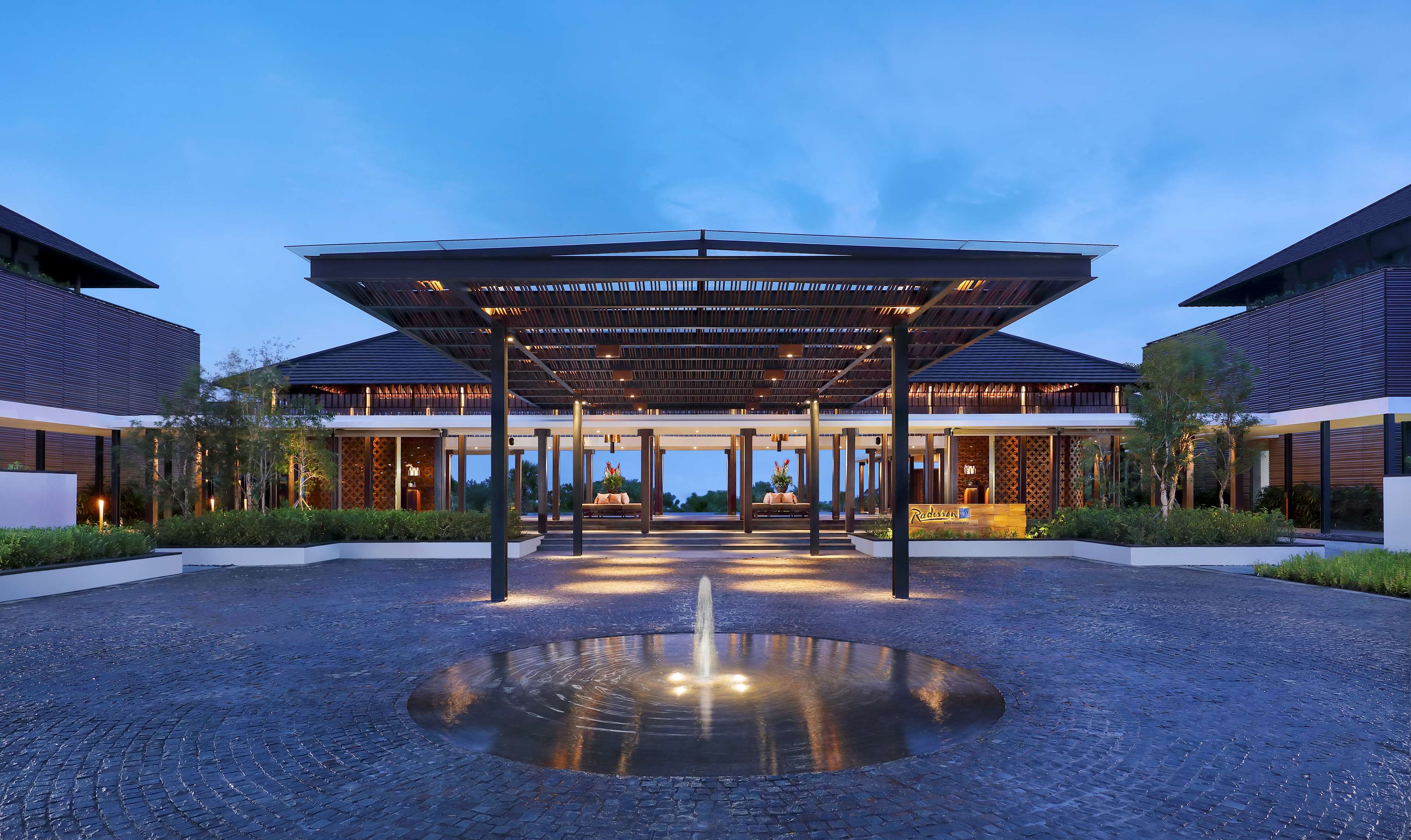
Radisson Blu Resort & Villas, Bali Uluwatu

Svanata Uluwatu Bali Resort

Le Cliff Bali
Expériences sélectionnées près de Thomas Beach (Pantai Thomas)
Curated guided tours and local adventures operated within easy transit of this landmark.

Nyang Nyang Cliffside Tandem Paragliding
Soar along the breathtaking 100-meter limestone sea cliffs of Nyang Nyang with bird’s-eye views of reef breaks and the Indian Ocean.

Karang Boma Sheer Cliff Coastal Walk & Sunset Drift
Traverse limestone headlands with sweeping ocean panoramas and cliffside sunset views.

Bukit Peninsula Secret Beach Trek & Drone Photography Tour
Curated Balinese experience: Bukit Peninsula Secret Beach Trek & Drone Photography Tour. Part of Bali Expert Guide's signature curated journeys.